
Oooo!
CityCyclingEdinburgh Forum » Infrastructure
Loanhead – Gilmerton cycle route Consultation
(167 posts)-
Posted 9 years ago #
-
Interesting.
Intrigued by the land owned by "Railway Paths Ltd" - who are they?
Looks like a pretty easy win, so can't complain, though I'd question how many people would use it. It could be nice for weekend pootling around but I don't imagine there's the biggest demand for commuters from Shawfair to Roslin... Saying that, that commute by bus would be a swine, and if cycling becomes the easiest option then why not?
Odds of this actually linking in with the new housing projects in the South of the city? Or is it more likely to be built then ripped up for utilities/putting a road on/to stop undesirable cyclists entering the area?
Posted 9 years ago # -
"Treatment of invasive species - July-September 2016"
Presume they mean hogweed/ivy/wasps and all that lovely stuff, rather than neds on motorbikes...
Posted 9 years ago # -
Intrigued by the land owned by "Railway Paths Ltd" - who are they?
Sustrans' land owning arm.
Posted 9 years ago # -
OK thanks. Was picturing some sort of British Rail spin-off, or post Beeching land grab, to hold the former railway assets in perpetuity.
Sustrans owning the land makes life much easier I guess!
Posted 9 years ago # -
Now 'arms length' (or something).
"
THE RELATIONSHIP WITH SUSTRANS
Railway Paths works closely with Sustrans. The two organisations share similar objectives and refer to each other as “sister charities”. Nevertheless, Railway Paths is an entirely independent charity, with its own board of trustees. It receives no financial support from Sustrans, and the two organisations are financially independent.
"
Posted 9 years ago # -
"It receives no financial support from Sustrans"
Don't know if money goes the other way or if Sustrans gets 'use of land' cheap.
Some income used to (and presumably still does) come from wayleaves, where utility companies had to pay to put pipes under/along paths.
Posted 9 years ago # -
to hold the former railway assets in perpetuity.
That was the BRB(R), or British Railways Board (Residuary), which held all former rail assets to either dispose of them or retain them for future rail schemes.
"On 30 September 2013, the company's assets and responsibilities were split between the Department for Transport, Highways Agency, London and Continental Railways, Network Rail and the Rail Safety and Standards Board.[2] Following these transfers, BRBR was abolished.[3]"
Given how recently this line had connected rails, it possibly was never in BRB(R) and probably went straight from Network Rail ownership to the new organisation.
Posted 9 years ago # -
I went along the 'extension' last year.
See final 3 photos -
http://citycyclingedinburgh.info/bbpress/topic.php?id=1587&page=22#post-173209
Posted 9 years ago # -
"Given how recently this line had connected rails"
Last track + sleepers not removed until 2011, but there may have been no trains since 1991.
https://www.railscot.co.uk/Edinburgh_Loanhead_and_Roslin_Railway
Posted 9 years ago # -
Sustrans have a planning application in for a ramp from Gilmerton Road to the proposed new cycle path between Gilmerton Station and Shawfair, so seems like this is going ahead soon.
Posted 9 years ago # -
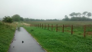
Things happening on this. Cycling back from Loanhead yesterday, the fence across the old railway line at Lasswade road has been taken down, and someone has been along cutting back all the vegetation.
Possible to cycle all the way to the A7, although hard work as it's still railway ballast in places (loose 25-40mm gravel)Also no access onto the A772 at Gilmerton, but Frenchy's link suggests this might change
Posted 9 years ago # -
To start next month!
http://www.sustrans.org.uk/news/construction-new-walking-and-cycle-route-between-gilmerton-and-shawfair-start-next-monthPosted 8 years ago # -
"
Construction of the route is set to start mid-August, and as part of the works traffic management will be in place on Old Dalkeith Road and Gilmerton Road at various stages.
"
Problem for people who cycle on these roads unless done well(?)
Posted 8 years ago # -
Obviously a good thing - continuation of existing path eastwards along old railway line.
Doesn't really connect Shawfair and Millerhill to the rest of Edinburgh.
Various lost (for ever?) opportunities along/close to the Borders Railway corridor.
Posted 8 years ago # -
This is great news for us. I can get to Dobbies for cake a lot easier when this path is extended as far as the Drum. Also when my husband works in Leith this will help him as he currently hates trying to come off at Lasswade road to do the last stretch into Gilmerton.
Posted 8 years ago # -
JCBs on the old railway track below Gilmerton Road (it's the first time I've passed in daylight for a while)
Posted 8 years ago # -
Passed by Gilmerton Road and Gilmerton Station Road this afternoon: there seems to be tarmac laid along the route of the old railway line from Lasswade Road to just short of the Gilmerton Road overbridge, and a fine hardcore foundation from there onwards towards Old Dalkeith Road.
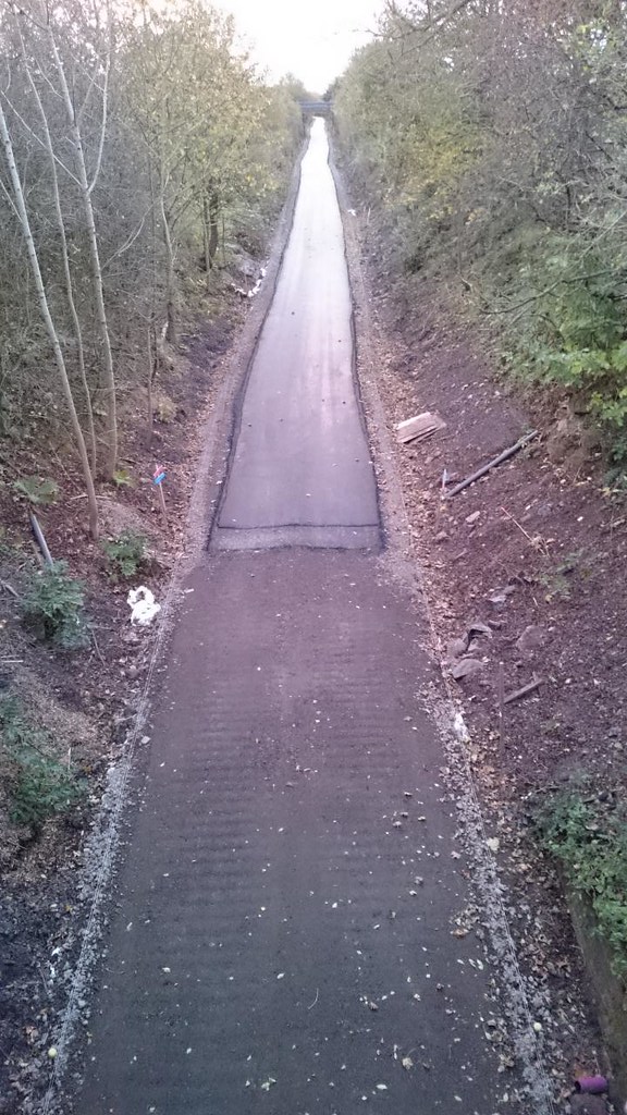
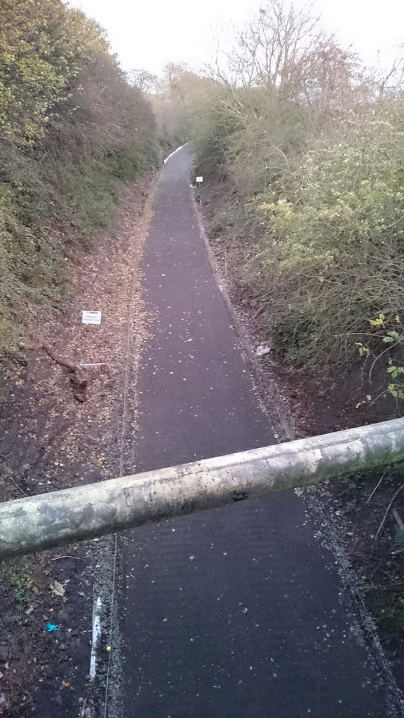
Certainly looks a whole lot better for cycling than when I tried to take my CX bike along the trackbed complete with in-situ ballast earlier this year. Quite surprised at how quickly this has gone in, TBH.
Miller Homes seem to be putting in a new development along the west side of Drum Street down to Gilmerton Station Road. There also appears to be a new development to the east of Old Dalkeith Road, where the old railway line crosses over the road. I didn't get a good look at that because I was driving at the time, but it looked from below as if there is work being done on the old railway line there as well.
So: more green belt development, but a new cycle route. Swings and roundabouts?
Posted 8 years ago # -
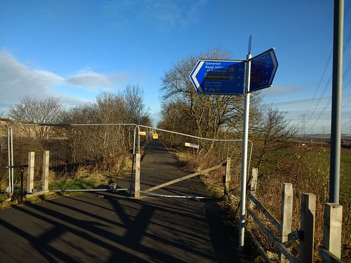
Where will the access be at the other end? I tried that once after looking for the fabled Straiton Pond path anti-christian gate, gave up due to the tyre-shredding and walked back to the bit here it scrapes alongside the road, but I didn't know where I was going to end up.
Posted 8 years ago # -
Found this, must there must be other stuff -
"
Sustran response - dated 22 August 2016
Sustrans Scotland welcomes the opportunity to provide comments on the proposed development masterplan guidance document for Gilmerton Station Road in Edinburgh.
Sustrans Scotland is planning to develop a cycle route on the disused railway line which runs adjacent to sections of Gilmerton Station Road. This line has already been surfaced and lit to the standard of the National Cycle Network from Roslin to Lasswade Road by a partnership of City of Edinburgh Council, Midlothian Council and Sustrans through the Community Links project. This route will also connect to Quiet Route 61 into Edinburgh.
Sustrans owns the disused railway line (formerly the line to Bilston Glen Colliery) from Lasswade Road to the Millerhill terminal. Scottish Government has pledged funding to complete the route on the former railway eastwards from Lasswade Road, which, once finished, will offer users an effective commuting route under the City Bypass from Midlothian to Edinburgh, and a safe, traffic free link to Shawfair Park and Shawfair Station on the Borders Railway. This development therefore offers the potential of a well-connected community with a two mile traffic-free route to a commuting railway station ten minutes from the city centre and access to a wider of-road network for both recreational and utility cycle and walking trips.
"
Posted 8 years ago # -
AHH... Finally that wee stub disappearing off into the fields gets somewhere to lead?
 Posted 8 years ago #
 -
I'm looking forward to this opening as it's in my general neck of the woods and nice fresh tarmac will be a joy. It'd be a lot more useful though if there were a plan to somehow connect it to the paths at the Infirmary/University. Old Dalkeith Road is as unfriendly as it gets up yonder.
Posted 8 years ago # -
Oh brill. I went to Dobbies from Roslin a couple of weeks ago and it wasn't tarmaced yet. Looking forward to being able to go offroad with my children all the way to Dobbies now for cake
Posted 8 years ago # -
It'd be a lot more useful though if there were a plan to somehow connect it to the paths at the Infirmary/University
This should happen when the Edmonstone site is "developed".
Posted 8 years ago # -
@wingpig: Whereabouts is that wee stub? Is it somewhere in the vicinty of Shawfair?
As for access to the path at the Straiton end, I find this pretty straightforward coming from the Kaimes crossroads direction: bus lanes and cycle/shared use paths for most of Burdiehouse Road and under the bypass, bear left at the traffic lights to pick up Loanhead Road then down the path that runs parallel to Edgefield Link and round the eastern edge of the Straiton Pond nature reserve to pick up the railway path about 150m before it goes under the bypass. IIRC there's one slalom type barrier at that point, I can't recall any other gates on that route but I may be mistaken. I've not noticed any significant tyre-shredding risk. The underpass under the bypass looks like the sort of place that will be full of broken glass, but somehow doesn't ever seem to be (one could always walk through if it was a mess, though I agree it would be inconvenient).
Proceeding in a north-westerly direction along Old Dalkeith Road the other day, I noticed that the access ramps for the cycle path (on the east side of the road) look like they're well on the way to being finished. It looked like they just need a bit of landscaping putting in.
I must try taking a donder along the new path soon, now that I've finished fitting the new groupset to my CX bike.
Posted 8 years ago # -
@newtoit: "Treatment of invasive species - July-September 2016"
Presume they mean hogweed/ivy/wasps and all that lovely stuff, rather than neds on motorbikes...
There was definitely Japanese Knotweed amongst the greenery alongside the stretch between the underpass under the bypass and the Lasswade Road access last time I rode along there.
Posted 8 years ago # -
Gilmerton Station Road section is nearly ready:
Posted 8 years ago #
Reply »
You must log in to post.
 posts
posts
