CityCyclingEdinburgh Forum » Infrastructure

Loanhead – Gilmerton cycle route Consultation

(167 posts)

No tags yet.


  1. Frenchy
    Member

    while (local) route 61 (as shown on OpenStreetMap, at least*) is north of the Esk and is for Danderhall and Shawfair.

    Not quite - QuietRoute 61 starts at the southern end in Roslin, goes to Gilmerton Station Road by the path this thread's about, and then up Lasswade Road and through the back streets of Gilmerton to Moredun. I think it now continues on through the RIE to Niddrie, but the council's maps are out of date.

    Definitely doesn't go to Lasswade.

    @jonty - no, the section of path currently being built is an extension of the Gilmerton-Roslin route. This goes through Loenhead and currently terminates at Gilmerton Station Road. The new section carries on northish, through the Drum estate, past Danderhall to Shawfair.

    Posted 6 years ago #
  2. Frenchy
    Member

    I think it's high time they reopened the Lasswade viaduct.

    I've been wondering about the feasibility of this whilst staring at maps and trying to find flat routes between Bonnyrigg and Edinburgh. I'll need to go have a look at it some day.

    Posted 6 years ago #
  3. jonty
    Member

    Hrmm, looking back at the map I see that this would be much better described as coming of 61, not 196. I guess the Sustrans press office are just as confused about the route as we were earlier.

    Posted 6 years ago #
  4. Lezzles
    Member

    This is amazing. I'm born and bred Midlothianer and I know nothing about the Lasswade viaduct. My dad does lots of work with the rangers (and is an all round know it all). Will investigate....

    Posted 6 years ago #
  5. chdot
    Admin

    “I know nothing about the Lasswade viaduct”

    I do, but only from maps!

    Dropped pin
    near 30-18 Westmill Rd, Lasswade EH18
    https://goo.gl/maps/hkbmRYf9GmM2

    Posted 6 years ago #
  6. amir
    Member

    I think it's high time they reopened the Lasswade viaduct.
    And the tunnel? Even flatter

    Posted 6 years ago #
  7. chdot
    Admin

    “And the tunnel?”

    Ok, I don’t know where that is.

    Posted 6 years ago #
  8. Arellcat
    Moderator

    The western portal is in the trees at the bend on West Mill Road in Lasswade. You can see the stonework. The station was at the bend itself, and the viaduct is immediately west of West Mill Road. The eastern portal is hidden in a cutting full of trees.

    Posted 6 years ago #
  9. chdot
    Admin

    “The eastern portal is hidden in a cutting full of trees.”

    Grid ref?

    Accessible?

    Posted 6 years ago #
  10. Frenchy
    Member

    @chdot - I think it's here.

    From info I found here: https://www.railscot.co.uk/img/10/232/

    Looks like it's accessible, for some value of "accessible": https://www.flickr.com/photos/k-burn/15029970808/

    Posted 6 years ago #
  11. Frenchy
    Member

    So come the revolution, and the following radical increase in the active travel budget, is this the sort of thing we'd be looking for:

    Posted 6 years ago #
  12. amir
    Member

    I've always thought there should be a tunnel under Gilmerton to avoid the completely unnecessary hill climbs

    Posted 6 years ago #
  13. amir
    Member

    I think the Bonnyrigg tunnel has been mentioned previously on this forum. @cocteautriplets?

    Posted 6 years ago #
  14. ejstubbs
    Member

    @Arellcat: I think it's high time they reopened the Lasswade viaduct.

    Someone has to stop it falling down first:

    https://www.buildingsatrisk.org.uk/details/925100

    In 2013 Network Rail said that they don't own it, so it won't be them.

    (Note that it was built by Thomas Bouch, unfortunately rather notorious for another bridge he built that did fall down...)

    I'm very tempted to donder along sometime over the Christmas break to have a gander at the new bit of path to Shawfair.

    Posted 6 years ago #
  15. chdot
    Admin

    "I'm very tempted"

    Nah it's not temptation, it's a sound plan.

    Take a camera...

    Posted 6 years ago #
  16. Frenchy
    Member

    Walked along the new path from Lasswade Road to Danderhall. It looks fantastic.

    IMG_20171223_082929 by Frenchy, on Flickr

    IMG_20171223_084242 by Frenchy, on Flickr

    IMG_20171223_083525 by Frenchy, on Flickr

    IMG_20171223_085410 by Frenchy, on Flickr

    IMG_20171223_085425 by Frenchy, on Flickr

    IMG_20171223_085455 by Frenchy, on Flickr

    IMG_20171223_085507 by Frenchy, on Flickr

    IMG_20171223_085555 by Frenchy, on Flickr

    Will cycle along later today, probably.

    Hopefully there'll be a connection to the south/east side of Danderhall somewhere, so that you don't need to go onto the A7.

    No Drum St ramp yet either.

    Posted 6 years ago #
  17. glasgow megasnake
    Member

    Great photos, thanks :)

    those steps look like they'd be fun on the right bike.

    Posted 6 years ago #
  18. Trixie
    Member

    Whee! That looks great. Thanks for the pics.

    It may be the only path in Edinburgh which is clear of leaf litter.

    Posted 6 years ago #
  19. Frenchy
    Member

    Cycled along earlier. Lovely with the tail wind heading towards Shawfair, less lovely on the way back, but that wasn't the path's fault.

    [+] Embed the video | Video DownloadGet the Video Widget

    Posted 6 years ago #
  20. Rosie
    Member

    Great Frenchy. I look forward to checking it out when the weather suits this fairweather cyclist.

    Posted 6 years ago #
  21. Lezzles
    Member

    I cycled from Roslin to the Drum along this route yesterday. What really struck me was how much better the surface is because its canted a bit. From Bilston Viaduct through Loanhead to Straiton Pond there is loads of standing water (and a mini waterfall where an outlet pipe was spewing cold water onto the path) but once you hit the new track its lovely with no standing water as its all running off the sides.

    Posted 6 years ago #
  22. amir
    Member

    It's also pretty well lit

    Posted 6 years ago #
  23. ejstubbs
    Member

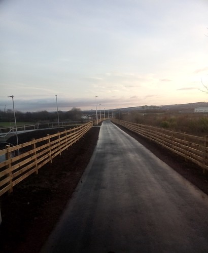
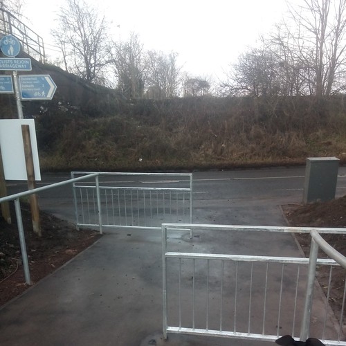
    I rode the new stretch of cycle path the Thursday after Christmas, on the way home from my first trip to Glentress for many a year. I agree that the surface is very good - although I did notice that the edges are a bit wavy in places! I don't know whether there's more to be done along the edges - soakaway drainage or something?

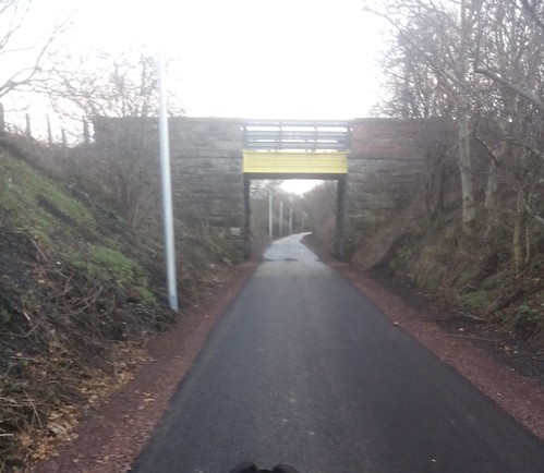
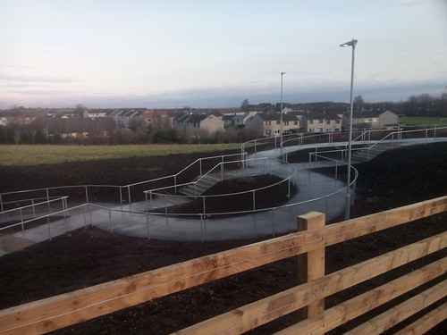
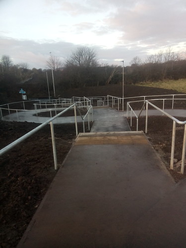
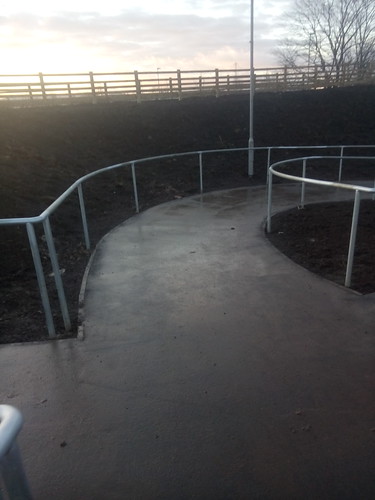
    I also explored the "stubs" at the Shawfair end a bit. The first one on the south side of Shawfair Avenue seems to follow the continuation of the route of the old railway line, and heads off across a rough field toward what should probably end up as a junction with The Kaims, as previously mentioned on this thread. Further along, just short of the A6106 roundabout, is the stub which is the start of The Kaims itself. On the north side there was one 'blind' stub that seemed to go nowhere in particular (yet), and a second one further west that currently seems to exist purely to provide an access route to the old Newton church - that area is otherwise surrounded by preparatory earthworks (and what looks a bit like a miniature, semi-subterranean velodrome, but which is probably destined just to be a pedestrian path around a water feature of some kind).

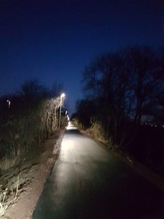
    I went further on, in to Newton village itself, and crossed the Borders Railway via a seemingly interminable series of zig-zag ramps. Then on past Shawfair station, and looping back to the A6106 past what looked like yet another building site, thence back to the cycle path and onwards back the way I'd come.

    @chdot: The Marshalling yard is no more.

    My understanding is that on the 'up' (eastern) side of the site a new depot for the EGIP trains has just recently been completed, and I've heard talk of a facility going in there for the new Hitachi trains in the ECML as well. Network Rail had a change of policy a couple of years back which meant that the PW depot, which was on the verge of becoming moribund, is now an infrastructure hub dispatching engineering trains across the whole of Scotland. I've also heard that the line through Millerhill will at some point become available as a diversion route for passenger services off the ECML. So it doesn't look like the place is going to cease being a railway altogether for a while yet, and it may actually get busier than it's been for a while before very long.

    I'd agree that it should not be (?have been?) beyond the wit of man to provide a link to the access road for the Energy Centre/RERC Project site on the 'down' (eastern) side, and thence onwards to Whitehill Road and New Craighall. (I don't know whether there might be issues with ground contamination in the area where Monktonhall Colliery used to be.)

    Another possibility might be to put in another zig-zag ramp bridge over the railway where it severs Whitehill Road just north of Old Craighall Road.

    Overall, though, it looks to me as if there's so much potentially going to be built in that whole area - going by the various stub roads and cleared sites - that there will likely be some reluctance to put in new facilities until the plans are a good deal clearer. The key, in that case, would seem to be to make sure that active travel is properly accounted for in those plans.

    Posted 6 years ago #
  24. McD
    Member

    Looks lovely. The only problem that I see, as with most old railway paths - is that you have to keep pedalling for ages. As a city dweller, I'm used to lots of stops fro traffic lights etc and to chatch my breath :)
    It would be good if there were a few places with a bit of a view to stop and have a rest with picnic tables and benches and maybe some Artwork - perhaps that's to come?

    Posted 6 years ago #
  25. Trixie
    Member

    There's a sad lack of benches/stuff all along that stretch to Roslin. A bench or two near the viaduct, I think, and a cute wee cobbled-together tribute bench near to Dryden Farm. I like that one, I'm sure I have a pic somewhere. Spots to pause without standing about looking plain puggled are definitely desirable.

    Posted 6 years ago #
  26. chdot
    Admin

    For anyone interested in the railway history -

    http://pages.ebay.com/link/?nav=item.view&alt=web&id=253346781918&globalID=EBAY-GB

    Posted 6 years ago #
  27. ejstubbs
    Member

    More info about the new EMU stabling/servicing facility at Millerhill here.

    Posted 6 years ago #
  28. Lezzles
    Member

    @Trixie that's 'Murphy's bench' and 'Tam's tae' you're talking about. They got repainted last year after the rain washed it all away. Love the signs written on them - always makes me smile.

    The picnic bench at the farm gets used a lot but most of the other benches get limited use apart from the odd elderly dog walker.

    Posted 6 years ago #
  29. jss
    Member

    It's a nice path with lovely smooth Tarmac and lights every 15 yards or so and rather nice going through the fields of the Drum Estate, but why?
    I can't see much reason to want to go from straiton to Shawfair or vice versa
    Hence I mainly encountered people walking dogs on the path
    I wish the money had been spent on a segregated cycle path into edinburgh from Midlothian- from Hardengreen or Dobbies- that would be useful and reduce traffic.

    Posted 6 years ago #
  30. I were right about that saddle
    Member

    rather nice going through the fields of the Drum Estate, but why?

    Automobile drivers have not been inconvenienced. Safe cycling has been created. All boxes ticked.

    Posted 6 years ago #

RSS feed for this topic

Reply »

You must log in to post.


Video embedded using Easy Video Embed plugin