CityCyclingEdinburgh Forum » Infrastructure

Post Powderhall (coming soon??)

(267 posts)

  1. chdot
    Admin

    "Network Rail / Rail Delivery Group have provisional plans (post-2019)"

    Is that the same plan that they abandoned a few years ago?

    I think it's reasonable to assume that sometime a loop line will be built and also that a bridge c/would be built.

    At worst there would still be a path between Powderhall/NEPN and Lochend Park.

    Posted 7 years ago #
  2. Klaxon
    Member

    The plan a couple of years ago was for two sidings ending at the London Rd bridge as a part of EGIP before it's 'descoping' so as to free up some bay platforms. The plan back then was for 6 trains per hour to Glasgow via Falkirk High on project completion and I think we're back to 4 trains but 30% longer now.

    This new plan would be to add additional flexibility in the East End of the station

    Posted 7 years ago #
  3. chdot
    Admin

    Was the EGIP plan just sidings and no loop?

    Does the new plan include the loop?

    If so, what would be the operational benefits?

    Posted 7 years ago #
  4. Klaxon
    Member

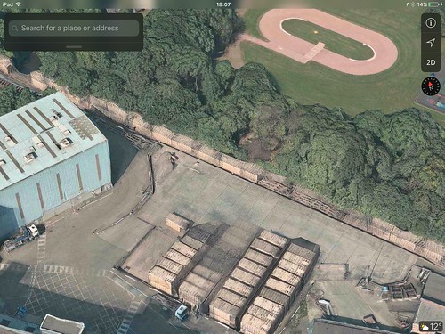
    Yea EGIP was two west facing sidings and no loop around the back of Meadowbank

    The new outline plan is to add a third line as far as Powderhall Junction. This is presumably reusing the trackbed via Meadowbank, but it's never explicitly stated.

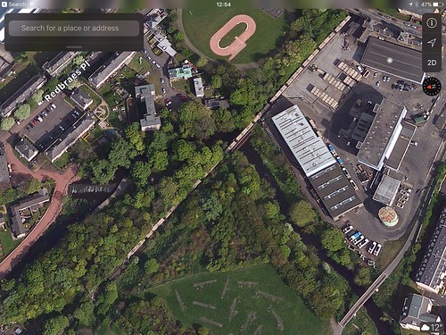
    Benefits are being able to dispatch a North Berwick or Borders Line train onto the 'loop' and then have a fast overtake it before Craigentinny, and being able to dispatch an empty East Coast set going to the depot before the depot is ready for it.

    Currently 'platform blocking' is a bit of a thing at Waverley as you can't send an EC set to the depot early to free up a platform. It will block the line at the velodrome until the depot is ready to take it in and then both lines for 5-8 minutes while crossing into the depot.

    It's really subtle operational stuff

    Details (or lack of) are at https://www.networkrail.co.uk/wp-content/uploads/2016/11/Scotland-Route-Study.pdf (via here) - page 61 along with every other major project you're likely to see thrown around in the next 20 years.

    There's a bit of commentary as to further justification and timeline in the appendices starting from page 81ish

    Posted 7 years ago #
  5. chdot
    Admin

    Thanks, seems like a "good idea" - so strange it's not a bigger priority/ done as part of Borders Line.

    Can't be that expensive.

    Posted 7 years ago #
  6. Klaxon
    Member

    None of this work precludes the Chancelot Path being extended from it's current terminus to Lochend Butterfly Way and maybe up to Marionville Rd with landowner agreement to open a route via that strip of car parking

    The process to close (or truncate) a freight line is far less arduous than one which has seen passenger use recently.

    Posted 7 years ago #
  7. chdot
    Admin

    "None of this work precludes the Chancelot Path being extended from it's current terminus to Lochend Butterfly Way"

    Yes, suspect biggest issue will be 'money'.

    "and maybe up to Marionville Rd with landowner agreement to open a route via that strip of car parking"

    That would make a lot of sense.

    Posted 7 years ago #
  8. chdot
    Admin

    Wholly unrelated, just an(other) example of 'stuff happens' -

    "

    A COUNCILLOR has hit out after Bradford Council put a plot of agricultural land up for auction later this week with a guide price of £30,000.

    Councillor Jeanette Sunderland, leader of the Lib Dem group, called the plan “crazy” and said the Council was selling off land just to raise money.

    She said alternative options, such as additional parking for Apperley Bridge railway station, or an entrance to a new country park, should be looked into before selling the land was considered.

    "

    http://www.wharfedaleobserver.co.uk/news/15243935.Anger_as_Council_puts_land_that___39_could_have_been_station_car_park__39__up_for_auction/?ref=mrb&lp=6

    Posted 7 years ago #
  9. neddie
    Member

    Even if Network Rail do build a line from Abbeyhill to Restalrig round the back of Meadowbank, there is no reason a bike path couldn't be built alongside it.

    Posted 7 years ago #
  10. crowriver
    Member

    "Even if Network Rail do build a line from Abbeyhill to Restalrig round the back of Meadowbank, there is no reason a bike path couldn't be built alongside it."

    Dunno about that: not much space left now that either side of the track bed at Lochend butterfly has been developed. At the Abbeyhill end, maybe: depends very much on the track alignment I suppose. Also not clear how any path could connect to anything at Abbeyhill if there's a live railway alongside, possibly blocking any exit.

    I suppose theoretically there could be a path via Abbeyhill on the western edge, along the northern edge of the railway bridge, and connecting to the path at the southern edge of Regent Road park. However this would be the only connecting point beyond say Norton Park, as you'd have no other way of exiting/entering the path. Also not convinced there's room on the bridge for a railway line and a path.

    Posted 7 years ago #
  11. chdot
    Admin

    "Even if Network Rail do build a line from Abbeyhill to Restalrig round the back of Meadowbank, there is no reason a bike path couldn't be built alongside it."

    Presume you mean the short stretch to the Velodrome?

    If so - yes, IF line reinstated as single track.

    If I was Network Rail I would have had the Abbeyhill Loop in use for years (maybe as part of the Borders Line project) and doubletracked for maximum flexibility.

    I suspect NR will hum and haw for many years to come - 'we might do it, and it might be doubletracked'.

    Posted 7 years ago #
  12. chdot
    Admin

    "I suppose theoretically there could be a path via Abbeyhill on the western edge, along the northern edge of the railway bridge, and connecting to the path at the southern edge of Regent Road park."

    Yeah I even suggested that to CEC years ago, probably when it was RailTrack. Part of the reaction was 'they are too difficult to deal with'...

    Posted 7 years ago #
  13. crowriver
    Member

    "Part of the reaction was 'they are too difficult to deal with'..."

    Yeah I suspect that unless Transport Scotland specifies a path alongside a new/reinstated bit of railway (e.g.. Bathgate - Airdrie) then it's unlikely to happen. Shouldn't be like that, but...

    Probably more productive in the meantime to focus on the St Mark's / Powderhall to Lochend Park / Marionville Road section. Maximum benefits for the investment.

    Posted 7 years ago #
  14. chdot
    Admin

    "Probably more productive in the meantime to focus on the St Mark's / Powderhall to Lochend Park / Marionville Road section. Maximum benefits for the investment."

    Yep.

    Posted 7 years ago #
  15. crowriver
    Member

    Interesting snippet from independent council candidate Harald Tobermann:

    "Cycle path/walkway extension
    The closure of the Powderhall depot is a brilliant opportunity to add green infrastructure and make St Mark’s and Lochend parks accessible right from the centre of the area. High priority! Could have been financed from developer contributions in the past, but Council missed many tricks. Frustration with the latter is one of the reasons that made me decide to compete against sitting party-councillors in this election."

    https://t4leithwalk.net/resources/

    Posted 7 years ago #
  16. chdot
    Admin

    Glad that he's keen, but can't really blame CEC for not getting developer contributions for something that was/is far from 'ready to go'.

    Posted 7 years ago #
  17. crowriver
    Member

    True. I was just intrigued that there is a candidate actually mentioning this at all.

    Posted 7 years ago #
  18. chdot
    Admin

    "I was just intrigued that there is a candidate actually mentioning this at all."

    Presumably MANY locals would welcome this route, so shouldn't be hard to get 'support'.

    Posted 7 years ago #
  19. chdot
    Admin

    "

    t is over 80 years since anyone caught a train at Leith Walk station

    "

    https://www.railscot.co.uk/Edinburgh_Leith_and_Newhaven_Railway

    Photos -

    https://www.railscot.co.uk/locationnew.php?loc=Leith%20Walk

    Posted 7 years ago #
  20. Klaxon
    Member

    Anyone here with a video camera drone capable of about 300m autonomy want to help out filming of the line for future campaigning?

    Posted 7 years ago #
  21. chdot
    Admin

    "Anyone here with a video camera drone"

    (PM Klaxon if you're shy.)

    If you have an iOS device, Apple's Maps is almost as good...

    Posted 7 years ago #
  22. Roibeard
    Member

    I've got access to high res aerial mapping via the university. Not quite the same thing as a drone survey, but perhaps worth a look. PM if you're interested.

    Robert

    Posted 7 years ago #
  23. chdot
    Admin

    Interesting.

    Do you know how recent images are?

    Posted 7 years ago #
  24. Roibeard
    Member

    @chdot - the images of Edinburgh appear to be June 2015, although it's likely to be a rolling programme.

    The source data is from "Getmapping".

    Robert

    Posted 7 years ago #
  25. crowriver
    Member

    @chdot, also you can use Apple Maps on a Mac computer...

    I'm thinking the aerial images of Abbeyhill/Easter Road are about two years old (other areas may vary). This is based on the fact that the Urbane Den development is not shown at all, neither is the new student accommodation block at Bothwell Street. However construction of the student flats on Abbeyhill itself is shown. They've been finished for about 18 months, hence my estimate.

    I do like the way you can "fly" over the line though.

    Posted 7 years ago #
  26. chdot
    Admin

    "@chdot, also you can use Apple Maps on a Mac computer..."

    Depends how old...

    Posted 7 years ago #
  27. crowriver
    Member

    One thing that does strike you looking at images from a couple of years ago is just how much property development is taking place in Edinburgh, especially in Leith Walk/Easter Road/Abbeyhill. Incredible really when you consider the relative lack of envelopment in the previous decade.

    Also it's interesting to observe that railway tracks seem to extend across the Water Of Leith from Powderhall, as far as St Mark's Park...

    Posted 7 years ago #
  28. chdot
    Admin

    "railway tracks seem to extend across the Water Of Leith from Powderhall, as far as St Mark's Park"

    Well yes, that's needed (well was) for the refuse container trains.

    Obviously very fortunate that that bridge is still there.

    Railway path will also connect with Redbraes Park (alight here for Cycle Speedway).

    Easy project to sell.

    Just need ownership and the cash to resurface. (Sustrans/SG probably best options.)

    Posted 7 years ago #
  29. chdot
    Admin

  30. chdot
    Admin


    Posted 6 years ago #

RSS feed for this topic

Reply »

You must log in to post.


Video embedded using Easy Video Embed plugin