
I wonder if rather than redesigning the cycle infrastructure it would be possible to improve what's already here. When I commute in I want to get from A to B and back again as fast as possible. (within the law naturally)So for me I want the roads upgraded to the smoothest piece of tarmac possible. This would surely be a hit with car drivers as well as cyclists. It would save drivers and cyclists maintenance bills and allow road users to keep moving in a straight line rather than having to constantly avoid obstacles. As a bonus if we could shift the drain covers to under the kerb it would mean that cyclists wouldn't need to stay as far out. Some drains are so badly cratered that I find myself having to pull out of the narrow cycle lane i.e. St Johns Road area to avoid them or the debris. Where there are incident areas could we look to make them one way or redirect the cyclists another way. I assume that will always be easier than working out alternative routes for buses, trucks and cars. Where none of this is possible perhaps CCTV could be used to record images that can be reviewed in the event of an accident.
This would of course be costly but the main cost is in resurfacing roads that badly need it so surely that's an expected cost?
CityCyclingEdinburgh Forum » Infrastructure
Cycle Network
(364 posts)-
Posted 12 years ago #
-
"
would be possible to improve what's already here...
I want the roads upgraded to the smoothest piece of tarmac possible
"
Agreed.
Part of the problem is maintenance - lack of and lack of budgets.
This is part of the (seemingly arbitrary sometimes) capital/revenue split.
Is this universally a governmental problem or worse in the UK?
So roads deteriorate and are poorly 'repaired' until there is the need for a complete resurface job - which then comes out of the capital budget...
Posted 12 years ago # -
Robert, you're are absolutely correct. Furthermore, I have absolutely no desire to diminish the import of the four points you raise.
Like you, I am a vehicular cyclist campaigning for segregation. The question, then, is not where to end up, but where to begin.
There is only one publication out of Europe that answers this question, and this is Cycling: the way ahead for towns and cities (Chapter 8). And what it says is to think in terms of a network, and that "introducing" this network to the point where it functions - albeit at a minimum level to begin with - is "a prudent course to follow".
When we say that many main roads are "not suitable for cycling", we take a relatively simple job and make it very much harder. I don't believe this is what we mean when we talk about working with the authorities.
In my submission to the Transport Select Committee, I referred to another publication entitled Cycle Network and Route Planning Guide, in which the following point was made: “Strategic cycling plans should consider whether or not it is practical to design facilities so that they are suitable for cyclists of basic competence.” (Routes to school, etc, can be treated separately.)
Cycling: the way ahead speaks of “encouraging the mass of non-cyclists who are most likely to take up cycling again". The point being that it is possible to get around 8 - 10% of the population cycling fairly regularly without the need for segregated facilities. Certainly it should be possible to get 5 - 6% of the population cycling within relatively not very much time at all.
Posted 12 years ago # -
"I want the roads upgraded to the smoothest piece of tarmac possible. This would surely be a hit with car drivers as well as cyclists"
The other problem with the existing road network is the indiscriminate pummelling of its surface by all kinds of super-heavy motor traffic - q.v. previous threads concerning dynamic loads and powers of axle weights. If smooth tarmac for encouraging cycling is provided it ought to be protected from being swiftly rendered asunder or battered into lumpiness, even when not officially segregated.
Another thing worth checking over old posts about is the current non-provision of alternative routes during roadworks, like the current blocked cycle lane on the Morrison St approach to Haymarket. A network ought to be resilient enough to handle occasional service deviations, either through small and manageable route diversions or by being prioritised above/protected from other traffic in the case of positional diversions.
Posted 12 years ago # -
Further to my earlier comment, I would also like to bring to your attention research carried out in Portland, Oregon. The cycling coordinator there, Roger Geller, has written a paper called Four types of cyclists.

(Image from Ely Cycling Campaign) The people who routinely say that the roads are too busy or too dangerous are identified by Geller as 'The interested but concerned'. They make up about 60% of the population, and if Edinburgh is serious about a 15% modal share for cycling, it will need to address their concerns at some point down the line.
However, Geller identified another group whom he called 'The enthusiastic and confident', and it is this group which holds the key. They make up approximately 8 - 10% of the population.
This group "are comfortable sharing the roadway with automotive traffic, but they prefer to do so operating on their own facilities. [...] They appreciate bicycle lanes and bicycle boulevards."

(Image from peopleforbikes) Providing for the needs of 'The enthused and confident' is relatively not a difficult thing to do.
Posted 12 years ago # -
What Roibeard said (and I was too lazy to write :) )
Posted 12 years ago # -
:o)
Posted 12 years ago # -
"
And then this caught my attention from Mia Birk's presentation on riding a bike in Portland:
If we plan and build our cities around driving, then that's what we'll do. If we plan and build around bicycling and walking—and then encourage people to do so in ways that are meaningful to their lives—then that's what we'll do.
"
http://bikemapper.blogspot.co.uk/2014/01/route-selection.html
TRUE
The problem of course being that many cities (not least Edinburgh) were (initially) designed before cars. Somehow cars/traffic have been allowed to take over, and there is a remarkable amount of resistance to 'reclaiming the streets'!
Posted 12 years ago # -
I have completed an uncoded version of the proposed network. I can tell you that the total length of the network currently amounts to just over 125 miles.
I think there is much more to add, particularly to the south. I have incorporated 559's suggestion of a route using Clermiston Drive and Drum Brae Terrace - thanks again - but am curious to know the best way to continue this route westwards.
Anyway, I had set up a separate account on google, and laid all the routes down in a new map, only to find that it wouldn't all fit on the same page. Change of plan, then.
You can see the map here. For the moment, what I am most interested in are the non-functioning sections of the proposed network. Personally I regard cobbled streets as non-functioning, and barriers, and an absence of dropped kerbs, and places where there are No Cycling signs - as well as one-way streets.
Could you please tell me all of the non-functioning parts? Many thanks.
Posted 12 years ago # -
I personally think the canal shouldn't be included. If I were in charge, I'd discourage cycling along there (it is suitable for a gentle pootle, or for children if they're capable enough to not fall in the canal, but in my world all the speed merchants would be well catered for on the roads and wouldn't go on the towpath because it was slow and inconvenitent.) Anyway that's a personal opinion and others will disagree.
The Western Approach Road goes over Dalry Road - your route appears to jump off the bridge in order to pick up the path that goes round the back of the place where the petrol station was. Currently you can't cycle on the WAR at all - if you could, then you'd be able to cycle all the way to Lothian Road that way. (I think you know this and we're imagining a change to that road.)
Murieston Road is one way. Currently cyclists either use Murieston Crescent or McLeod St (we use the latter) which has such a shocking surface it might as well be cobbled.
Access to the Water of Leith path off the Corstorphine Road involves a flight of steps. There's also a MASSIVE flight of steps to get off the path and onto Belford Road. I'm interested as to why you've used that little bit of the WoL path and not the rest of it (some other parts are much more suitable for cycling (though see my opinions in the first paragraph!))
That'll do for now, I should do some work! I might have some more thoughts in a bit.
Posted 12 years ago # -
Could you please tell me all of the non-functioning parts?
Selfishly, the south east seems poorly served, and a "ring" is missing in general - but that's Edinburgh, all the current roads tend to run radially.
Imagine taking an arc from Cramond, Drumbrae, Sighthill, Craiglockhart, Braidburn, Liberton, Craigmillar, Joppa (or similar). I know I've just crossed most of the hills in the southwest, but perhaps there is a way round shoulders, etc that doesn't involve coming in to approximately Grange/Marchmont/NEPN.
Robert
Posted 12 years ago # -
"I personally think the canal shouldn't be included"
This is certainly a difficult one if a 'cycle network' is designed/assumed to have any sort of cyclist priority.
Meanwhile in London -
 Posted 12 years ago #
 -
"Imagine taking an arc"
Certainly Braid Hills Road should have a much reduced speed limit and decent 'cycle facilities' (it's wide enough) - or both.
Posted 12 years ago # -
Without being overtly negative, i'm not sure drawing lines on a map is adding much. I use google to navigate around Edinburgh quite a lot and I ignore all of their route suggestion and go with the ones i have had the best experiences on. If your routes are recommendations based on rider experience, thats different.
Posted 12 years ago # -
Drummond Place is most definitely non-functioning by your description. The cobbles are incredibly rough, especially between Dublin Street and London Street.
Posted 12 years ago # -
Thank you for all the comments - I will update the map this evening.
Posted 12 years ago # -
Accessing the canal towpath from Colinton Road using the bridge near Meggetland Sports Complex involves steps.
There are cobbles on the last section of the towpath near the Cargo Bar.Comely Bank Avenue and Dean Park Crescent are cobbled.
Access from Balgreen Road onto the Water of Leith path heading for Murrayfield would be a bit of a wriggle on a bike. That section of path is narrow, muddy and twisty. It actually gets better at the point where your route leaves the path and goes along Baird Grove - I think (if you are going to use the path) I would go over the bridge, along by the playing fields and then back over the Water of Leith just before the junction between Riversdale Crescent and Corstorphine Road.
Access from Longstone Road to the path that I never knew existed that connects through to Stenhouse Mill Lane involves a not very dropped kerb and then a couple of big steps (from google streetview and my knowledge of running along Longstone Road - but I'm now going to spec out the path next time I go out for a run...)
You've missed/ignored or don't know about the nice shiney new path next to the tram lines along Carrick Knowe golf course. This does connect up with the Stenhouse Drive/Broomhouse Drive "facilities".
The road that connects Gilmore Park to Leamington Terrace is one way for that short section. (It may be Lower Gilmore Place, it isn't clear from googlemaps)
Right, that'll do for now.
Posted 12 years ago # -
I have incorporated 559's suggestion of a route using Clermiston Drive and Drum Brae Terrace - thanks again - but am curious to know the best way to continue this route westwards.
Note that Drum Brae Terrace has speed humps on it – some of the worst kinds for cyclists too, although that doesn’t stop me cycling along it every day. To continue the route westwards, assuming that you are heading for the airport, you either have to choose using the main roads (Drum Brae South, Glasgow Road) or you have to navigate your way through a bunch of paths which are nowhere near as good as the NEPN, but if you know of them, then as has been discussed on other threads recently, it is possible to navigate your way over to the Glasgow Road in a straight-ish line. However, it’s much slower going than just using the roads (for me), so it is negligible which you should use. Probably depends on the type of cyclist you are.
Posted 12 years ago # -
"The road that connects Gilmore Park to Leamington Terrace is one way for that short section."
Which nicely takes us back to where we started - common sense contra flows
Posted 12 years ago # -
The route over Corstorphine Hill (Cairnmuir Road - Ravelstone Dykes) is non-functioning.
It is just about possible by Mountain Bike with a fit rider who is prepared to push/carry their bike, but not for others. (I know because I've tried and failed to find an alternative route to town that way) And even then it is quite a hill to climb just to get to top of Cairnmuir road.
What about a lower level E-W route on Belgrave / Forrester road?
I would also like to see more routes around the Gyle given it amount of people travelling there for work and the current bottlenecks for vehicles.
What about how the network links to out of town routes? and a seafront route from Cramond to Musselburgh?
Posted 12 years ago # -
@SimonParker very interesting project.
An oft-quoted reason people give for not cycling from A to B is "it's too hilly".
I found an interesting map based off OpenStreetMap showing Edinburgh's topography, and I wonder if a 'core' network ought to aim more for flatter routes.
Not necessarily the fastest or shortest, but routes that would be physically feasible for the greatest number of cyclists?
Posted 12 years ago # -
Hills aren't nearly as bad when the surface is agreeable, you aren't forced by traffic to try and ride faster than an easy pace and you don't have to hill start at every (motorist-prioritised) junction.
Posted 12 years ago # -
Indeed...I look back at my years commuting Dundas St and the Mound as a sort of rite of passage (almost literally...)
Posted 12 years ago # -
Thank you again for the response to my proposal. The only thing I ask now is for you all to move down to London and set up this facility there.
No, I'm being serious.
Okay, so let's have a look at the revised version of the proposed network (here).
At first glance you probably won't notice much difference, but actually I have altered the course of four routes.
The second green down now avoids the tiny path off Longstone Road.
The fourth green route down now avoids the canal.
The bottom orange route now avoids the West Approach Road.
The blue route in the city centre now avoids Dublin Street.
My thoughts about the canal are pretty much the same as fimm's and chdot's. In London, for example, my proposed design avoids the canal, except out in the suburbs.
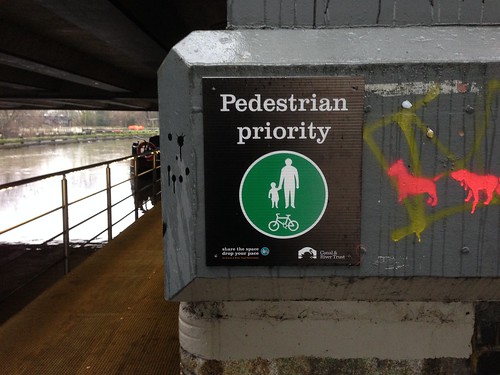
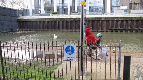
Of course, considerate cycling should still be permitted alongside the canal, with pedestrian priority. That doesn't change. But that's probably about the extent of it, I think.
The thing is, I see these big bold lines on Google maps and think, Oh my! I have to include that!
What goes for the canal also goes for the river? I don't know, I can't see what conditions are like with Google Street View. On the one hand, it looks like it can provide a reasonably direct route, but on the other hand, it doesn't seem very on-and-offable.
Cycling: the way ahead makes the point that only by studying a cycle route network does it become possible "to truly grasp the situation, to draw up a list of black spots and to act in a targeted and highly efficient fashion."
I have updated the uncoded version as well, showing the non-functioning parts in red. This was a bit of a mistake, since the railway stations are also shown in this colour. However, if you hover your cursor over the box marked 'Map' (top right) the terrain box reveals itself, and everything is much more visible in this mode. Map here.
As you can see, there is not much that isn't functioning. I would stress, firstly, that this is a strategic network, and secondly, that I make no claims for subjective safety. My view is that if you don't have Bikeability Level 3 training, then ... cycle with an adult, on the pavement, or get the bus. Long-term, of course, I would want things to be different.
It's getting late now, but before I go to sleep, a quick word about the West Approach Road. I didn't know about the no cycling rule, but having had a look at it on StreetView, I see a muddy path alongside the road. When this sort of thing happens, this usually indicates a need for a pavement / shared-use path.
Posted 12 years ago # -
The river path is commutable-with-consideration between Shore and Warriston, ped-and-dogwalker-biased to Stockbridge, generally narrower, patchier and very-considerate-pootling-only upstream to Chesser, narrow to Longstone then commutable-but-frequently-muddy to Balerno.
On your map, this affects the bit going past Inverleith Pond, the Dean-Roseburn section (which has steps at the Roseburn end and doesn't connect back to the road where your overlay indicates and is possibly still shut at Dean for tree-damage repairs) andthe Roseburn-Balgreen section (which is still mostly surfaced and wide enough only for trickling along)
Posted 12 years ago # -
Morining Simon
The canal is fine as a commute heading east until you get to the aqueduct at slateford. You can also get off it using a little path that goes under the railwayline just before the aqueduct and go through the park at longstone coming out at the new sainsburys where B and Q used to be. Traffic lights with quite a long sequence let you take the right turn up to the slateford filter lane onto the A70 where taking the left at the WoL visitor centre allows you to use a good section of the river (once tram works completed, maybe they have been) all the way to Murrayfield then round to the NEPN entrance at wester Coates. I do believe I will take this route to North West Edinburgh from SW Edinburgh this morning. Not a straight line more of an in then out like this
>
some fearless or drunkpeds do set off walking along the WAR and have made a grass verge a muddy path to nowhere. When you see them doing this they look very vulnerable
Posted 12 years ago # -
Hi there Simon just to be brutally selfish as an out-of-towner I drive to the Ingliston P&R and then commute in from there. I wonder how many others would be tempted to cycle the 7ish miles (maybe only in nice weather) if we could make the route to and from them safer and better. Also, if I wanted to park further out the only place I could find that is suitable i.e. not outside someones house and has security facilities is Uphall Station which is double the distance. As part of any network there be good provision for people to P&R which of course would hopefully reduce city centre traffic and stop the roads getting as knackered
Posted 12 years ago # -
To quote myself: "Murieston Road is one way. Currently cyclists either use Murieston Crescent..."
you know how we've been talking about desire lines? I go through the 5-way junction where Dalry Road becomes Gorgie Road most days. Yesterday evening, on my way home after work, I came along Dalry Road and stopped at the red light waiting to go across to Gorgie Road. I noticed four cyclists on the pavement to my right - the 4th was just coming up Murieston Road on the pavement. The 4 cyclists crossed Gorgie Road using the pedestrian crossing - some rode and some walked. One then cycled up the pavement on Ardmillan Terrace, 2 others walked across Ardmillan Terrace before cycling up the hill and the 4th ran across and did a nice speed mount before disappearing up Henderson Terrace.
And then the penny dropped. I quite often see cyclists come up Muirieston Road and use the pedestrian crossing to go up Ardmillan. Its a desire line.
(Note that to give Murieston Road a contraflow cycle lane would also require some way of letting the cyclists out at the junction legally!)
Posted 12 years ago # -
"My view is that if you don't have Bikeability Level 3 training, then ... cycle with an adult, or get the bus."
Really??
Think that needs a new thread.
Posted 12 years ago # -
"West Approach Road. I didn't know about the no cycling rule, but having had a look at it on StreetView, I see a muddy path alongside the road. When this sort of thing happens, this usually indicates a need for a pavement / shared-use path."
...
"some fearless or drunkpeds do set off walking along the WAR and have made a grass verge a muddy path to nowhere. When you see them doing this they look very vulnerable"
There has been 'talk' of a proper path here for years.
Would be a useful link.
May be under consideration as part of 'Canal to NEPN' plans.
Posted 12 years ago #
Reply »
You must log in to post.
 posts
posts
