CityCyclingEdinburgh Forum » Infrastructure

CEC Family Network Route 20

(28 posts)

No tags yet.


  1. chdot
    Admin

    Well this is what I did this afternoon -

    http://www.everytrail.com/view_trip.php?trip_id=2762270

    Now I have even less understanding of the purpose of the FN.

    This joins up various ancient and 'modern' bits of cycle 'infrastructure' mostly on roads which although not 'main' are mostly unpleasant and there are a host of compromises and crossings that I wouldn't choose to take children on.

    Signs only in place as far as Marionville Rd.

    Detour along well used desire line to Meadowbank retail park.

    Posted 9 years ago #
  2. wingpig
    Member

    That well-used desire line in full:

    [+] Embed the video | Video DownloadGet the Video Widget

    Fewer biological hazards than I expected.

    Posted 9 years ago #
  3. crowriver
    Member

    Thanks for sharing, guys.

    I know most of that route very well, though I've never really bothered with going through Lochend Park. Must give it a try with No.1 son. Don't fancy the Meadowbank retail cut-through much. Would hve been different when I was 15.

    We did Abbeyhill-Inverleith section together to see how feasible it would be for him to cycle on his own in a few years. All I can say is if he does it without adult shepherding, he'll be needing to stay on the pavement for long stretches. McDonald Road just not safe enough in either direction. Junctions in Inverleith near Botanics dreadful. We've already discussed the exit from Inverleith Park to the west so I'll leave it there.

    Posted 9 years ago #
  4. chdot
    Admin

    I'm glad you have confirmed my view that it's not what CEC should be pretending is a family route!

    "Don't fancy the Meadowbank retail cut-through much"

    Well it's hardly 'convenient', certainly wouldn't try to take an 'interesting' bike that way.

    It's clearly a well used route for people living on the Lochend Butterfly.

    I believe CEC would like a proper route but Network Rail are not keen to help...

    (Just to avoid confusion it's not part of Route 20!)

    Posted 9 years ago #
  5. kaputnik
    Moderator

    Newsflash.

    The bridge across the railway, and paths connecting Meadowbank Shopping Centre to Lochend Park / Butterfly / Albion Road should be open next week.

    Hurrah!

    Posted 7 years ago #
  6. chdot
    Admin

    Great!

    Must say I'm surprised.

    It's 'obviously' been 'a good idea' for years.

    I got the impression that Network Rail said "no" - 'and that's the end off it'.

    Posted 7 years ago #
  7. kaputnik
    Moderator

    I think the "no" bit was while they still owned the land between bridge and the new housing. The development has solved that issue.

    Posted 7 years ago #
  8. chdot
    Admin

    "I think the "no" bit was while they still owned the land between bridge and the new housing"

    Don't they still?

    Thought it was reserved for possible/maybe/future Abbeyhill Loop??

    Posted 7 years ago #
  9. kaputnik
    Moderator

    Yes you're right, they have reserved the old trackbed for "just in case" purposes, I meant the actual triangle of land within the old lines is now sold and developed.

    If they ever wanted to reinstate the railway they'd need to build new bridge(s) of course.

    Posted 7 years ago #
  10. chdot
    Admin

    "of course"

    Of course...

    Posted 7 years ago #
  11. Rob
    Member

    "reinstate the railway"

    That line is unused?! Why has it not been used to extend the NEPN, at least to Easter Road? Looks like an open goal to me.

    Posted 7 years ago #
  12. chdot
    Admin

    "That line is unused?!"

    Different line.

    Rail line that still exists is just for Powderhall refuse trains - until that depot is replaced by the one at Millerhill.

    The 'reserved' route is the loop that comes off the main line, goes past the remains of Abbeyhill station and on to the Commonwealth Games halt and back to main line.

    May or may not be required if the South Sub ever re-opens to passengers (extra capacity for trains east of Waverley).

    Posted 7 years ago #
  13. kaputnik
    Moderator

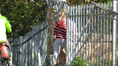
    The new development (Urbane Den. Or Urban Eden, whatever) sits in a triangle of land that was previously railway sidings etc. As Chdot says, there is still a line in daily use between Piershill Junction and Powderhall for the bin trains.

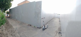
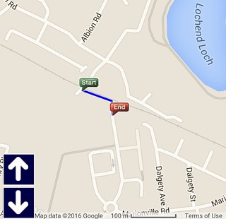
    The triangle was bounded by railways on all sides until fairly recently, trains coming from Waverley would turn off at Abbeyhill Junction, run under London Road and through Abbeyhill Station at which point they could either take the left fork and head for Powderhall and on to Leith or take the right fork and head for Piershill and the East Coast Main Line. Slightly longer back, they could also continue straight on for Leith Central, crossing the current railway line on a bridge in the approximate location of the current road bridge behind Sainsburys (the one that has been closed off for so long). A lot of the new "Lochend Butterfly" housing is built on the infilled cutting of the lines to Leith Central. There was a further line connecting Leith Central to Piershill that followed the south boundary wall of Lochend Park.

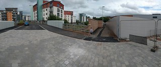
    There was an intention to build some turnback sidings on the trackbed at old Abbeyhill Station, but this was cancelled after EGIP was downgraded by Keith "Two More Lanes" Brown, after the trackbed was cleared and groundwork had been done.

    There's lots of scope for excellent extentions of the NEPN once the Powderhall line is closed and (perhaps) lifted. Leith Walk, Easter Road, Meadowbank would all get traffic-free, grade separated connections to the NEPN.

    I wonder if folks here are more in favour of the trackbeds being converted to foot/cycle ways or reserved for a long term aspiration to reinstate railway at Abbeyhill (difficult given the station was largely obliterated in recent years?)

    Posted 7 years ago #
  14. chdot
    Admin

    "but this was cancelled after EGIP was downgraded"

    Ah that explains why 'nothing seems to have happened'.

    Posted 7 years ago #
  15. chdot
    Admin

    "I wonder if folks here are more in favour of the trackbeds being converted to foot/cycle ways or reserved for a long term aspiration to reinstate railway at Abbeyhill"

    I think that will be yes.

    "(difficult given the station was largely obliterated in recent years?)"

    I think difficult is an understatement, PLUS not exactly cheap - especially in view of likely usage (even with passenger trains on South Sub).

    Porty would be a more useful station to reopen (not cheap or easy either).

    Posted 7 years ago #
  16. Nelly
    Member

    @k

    "The bridge across the railway, and paths connecting Meadowbank Shopping Centre to Lochend Park / Butterfly / Albion Road should be open next week"

    I presume this is a pedestrian / cycleable route only?

    Posted 7 years ago #
  17. kaputnik
    Moderator

    @Nelly yes - cars can only access the housing from the north (Lochend) side, across the bridge. There's paths allowing access to the South (Meadowbank) side through.

    Posted 7 years ago #
  18. kaputnik
    Moderator

    On further inspection of plans and drawings on the planning portal (12/03574/FUL) it looks like the connection from Meadowbank side has steps, so might not be brilliant for cycling cut-through.

    There also appears to be a connection to the Crawford Bridge on the plans, again with steps, that actually runs through the block of flats being built there.

    Posted 7 years ago #
  19. Nelly
    Member

    @k, cheers - I had visions of the traffic chaos that would cause if cars were looking to 'take a short cut'.

    Posted 7 years ago #
  20. kaputnik
    Moderator

    Still not open, but work looks nearly finished.

    Current status;


    North / Lochend side, new housing on right, looking across bridge over railway. The connecting path runs behind that brick wall on the left, behind the bridge parapet.


    North / Lochend side, you have a fairly long walk along the walled-in path in the direction of Sainsburys. It's not easily possible to see, but the path changes height a couple of times, not sure if there are ramps or steps.

    From the other side, it connects on to the pavement at the end of Moray Park, but it's roughly surfaced with chips and gravel at that bit, and there's a tight 90 degree turn before the path proper.

    Summary - it's a fairly narrow route and is walled in. It probably has a few steps. It's not really looking like it's going to be a convenient, conflict-free cycling route.

    Posted 7 years ago #
  21. Nelly
    Member

    "It's not really looking like it's going to be a convenient, conflict-free cycling route"

    Lets hope its just the wall that is stepped and the path is level. Not sure why they would build steps in when the ground is pretty level (or it was when it was the builders access) Would this not give them accessibility problems - i.e. are all new developments supposed to be wheelchair friendly?

    There is a similar one between Decathlon and Tesco at Hermiston Gait which has proved very useful to me on the occasions I visit decathlon on my way home.

    **just checked google streetview and there is a fair ramp, so ignore my "looks pretty level" chat !! **

    Posted 7 years ago #
  22. kaputnik
    Moderator

    Lets hope its just the wall that is stepped and the path is level. Not sure why they would build steps in when the ground is pretty level (or it was when it was the builders access) Would this not give them accessibility problems - i.e. are all new developments supposed to be wheelchair friendly?

    That's what I hope too, but you can just see in the bottom photo that the concrete retaining wall under the brick wall jumps up and then back down right at the bit where there are steps marked on the map.

    According to the plans on the portal, the steps are there to raise the height of the path to a level that would allow the railway to be reinstated underneath. Which is completely &*^*%$! stupid given there's a reinforced concrete retaining wall across the trackbed and the cutting has been filled in up to ground level!

    Posted 7 years ago #
  23. Nelly
    Member

    @k, as discussed on twitter last night - it is open, albeit with a variety of what are clearly temporary surfaces.

    There are no steps, but it doesnt look like its finished so that may change once they start the landscaping for the housing development.

    As you noted, on a bike, care needed at Moray Park end as there is a 90 degree blind turn.

    Useful cut through though.

    Posted 7 years ago #
  24. wingpig
    Member

    Lochend Butterfly - Sainsbury cut-through confirmed open and navigable.

    Posted 7 years ago #
  25. rbrtwtmn
    Member

    Can't work out where you all mean. Could someone share a link with a marker on openstreetmap.org please?

    Posted 7 years ago #
  26. wingpig
    Member

    It continues the line of the east footway of Moray place until it reaches the boundary fence of the railway, then follows that line (beside hoarding, then a new brick wall) to the bridge.

    Posted 7 years ago #
  27. chdot
    Admin

    Map -

    http://www.edinburgh.gov.uk/download/downloads/id/6463/explore_north_edinburgh_on_foot_by_bike_-_map.pdf

    (Not my idea of a quiet route in many places)

    Posted 7 years ago #
  28. Rob
    Member

    Top left corner, "Proposed future path extension". Technically off topic but that would be a great little gap filler between NEPN and Cramond.

    Posted 7 years ago #

RSS feed for this topic

Reply

You must log in to post.


Video embedded using Easy Video Embed plugin