CityCyclingEdinburgh Forum » Questions/Support/Help

Liberton to S.Gyle

(11 posts)
  • Started 7 years ago by newtoit
  • Latest reply from cb
  • This topic is not resolved

No tags yet.


  1. newtoit
    Member

    Hi all. Looking for a bit of advice.

    Looking at a potential job switch which would mean working at South Gyle (currently near Lothian road).

    I'd realistically be looking at driving at least some days, but can anyone comment on the cyclability to get there from Liberton Hospital, and how long you'd expect it to take a mere non-roadie mortal? Ofcourse a road bike may follow... I'm reasonably comfortable in traffic although naturally don't enjoy it.

    Looks as if driving could range between 25 and 50 mins so if it's consistently at the top end then cycling may come out trumps (shower availability dependent!).

    Posted 7 years ago #
  2. Frenchy
    Member

    Quite a few routes you take to do that, but all are going to be 12-14km, which shouldn't take much more than half an hour.

    The most obvious route, to me, is along Braid Hills Drive and Glenlockhart Road then onto the canal towpath at Slateford and come off at Sighthill. I really like cycling on Braid Hills Drive, even though it's a 50mph road, as it's nice and wide and has no traffic lights to stop at. I've never been on it at peak commuting times though.

    Frogston Road is similar, although probably less fun at busy times. Cluny Gardens would be a longer route, but avoids 40mph+ roads, and you'd be on the towpath for a greater fraction of your journey.

    An alternative to the canal is to take Longstone Road, then Saughton Road (can use the underpasses at Calder Road), then the cycle path beside the tram route to South Gyle.

    The quietest route is probably down Kirk Brae, through Marchmont and Bruntsfield and onto the towpath at Fountainbridge. Bit longer, and more climbing on the way home than other routes. Do you currently cycle this way to work?

    Posted 7 years ago #
  3. I were right about that saddle
    Member

    I cycled from Liberton to Fred's Death Star for a year. Didn't think I'd cycle every day at the outset but I did and really missed it when I stopped.

    Nice summer days you could nip through the Hermitage, Greenroofer's Railway Snicket and the canal.

    Posted 7 years ago #
  4. cb
    Member

    Interesting the Cyclestreets takes a more northern route than Frenchy's first few and doesn't opt for the canal.

    https://edinburgh.cyclestreets.net/journey/56425691/#quietest

    From Balgreen I personally prefer going via the Corstorphine back streets on Cycle Route 9 rather than Route 8 by the tram track.

    Sounds like the sort of commute with which you will slowly build up an array of routes to suit your mood and the weather.

    Posted 7 years ago #
  5. cb
    Member

    And regarding the Railway Snicket it will link nicely with the new path through the Royal Edinburgh site - looks promising at its eastern end.
    And two new pedestrian crossings for Myreside Road.

    Posted 7 years ago #
  6. chdot
    Admin

    "looks promising at its eastern end"

    Looks promising at its western end too.

    Posted 7 years ago #
  7. cb
    Member

    And by eastern I was obviously referring to western. Oops.

    Posted 7 years ago #
  8. chdot
    Admin

    Ah!

    Posted 7 years ago #
  9. Murun Buchstansangur
    Member

    Shared use path through Royal Edinburgh Hospital is now open (or at least no barriers). Starts promisingly (wide, pedestrian & bike sides) but it halts abruptly at the end of the new development and it is then a narrow gravel path to get back to the old REH road network. Have some photos, will see if I can upload them.

    Posted 7 years ago #
  10. neddie
    Member

    Cool. Might try that route again.

    Posted 7 years ago #
  11. cb
    Member

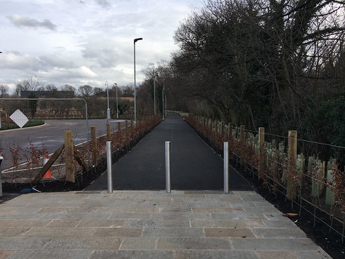
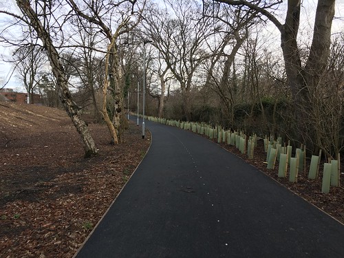
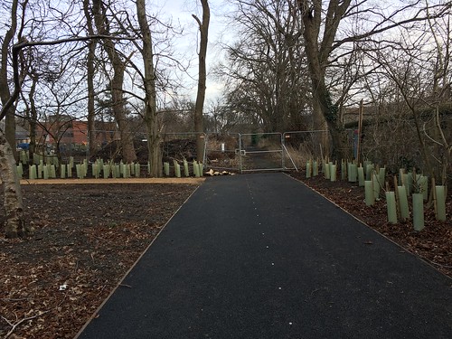
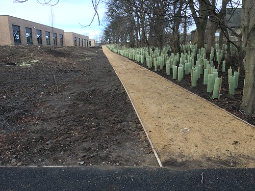
    I went through today; this is what it looks like heading in from Myreside Road.

    New Royal Edinburgh path

    Royal Ed path

    Turn sharp left

    New path, Royal Ed

    A smaller orchard still survives to the north of the path carpeted with a thousand un-picked apples.

    I have attempted to map it on OSM.

    Posted 7 years ago #

RSS feed for this topic

Reply

You must log in to post.


Video embedded using Easy Video Embed plugin