It’s not significantly less steep than DublinStreet.
By my rough calculations it's about 1:18 from the junction of Royal Crescent and Scotland Street to the crest of the climb at the SE corner of St Andrew Square, and about the same going straight up Dundas Street from its junction with Eyre Place. Wiki and RailScot have the tunnel's gradient as 1:27 but, as you point out, that's to the southern portal of the tunnel which is 11m below the level of Princes Street. I agree that that difference in levels at that location would seem to rule it out as cycle route, especially since Waverley Market now sits on top of said portal.
The opening behind the grating on Platform 20 at Waverley Station is for a ventilation duct for the tunnel, which runs from the site of the tunnel portal and through what used to be the site of Canal Street station beneath Waverley Market. Basically, it's just a big pipe from there back to the S side of Princes Street, rather than a tunnel.
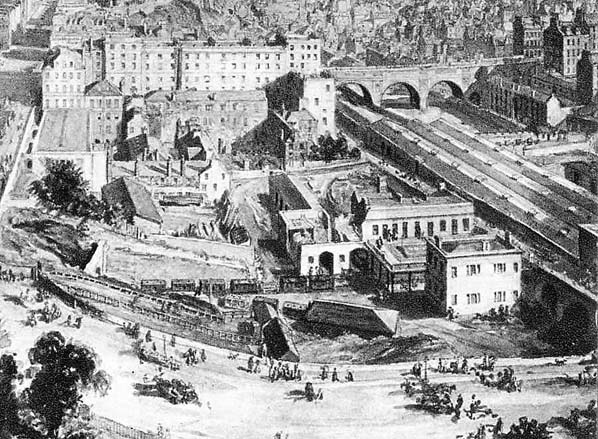
This picture on the Disused Stations web site gives a reasonable idea of the layout of the area when Canal Street station was in operation:

and this map shows how the Edinburgh, Leith and Newhaven Railway used to join what was then the Edinburgh and Glasgow Railway just to the west of what was at the time called North Bridge station, before the Easter Road Diversion via Abbeyhill was built in the late 1860s:

There's more detail about the current arrangement at the southern end of the tunnel on the Subterranean Britannica web site, and some photos of the interior of the tunnel apparently dating from 2014 on this blog, including a photo of the southern end (WARNING: NSFW)


 posts
posts
