Under the plans, which are currently out to consultation, all nine bus stops on the route would become floating, meaning a cycle lane runs between the bus stop and the pavement, so passengers must cross the lane to get on or off a bus.
I'm setting out to correct this, as I don't think it's right. I think from the plans, passengers must cross the lane to reach the waiting area for the bus.
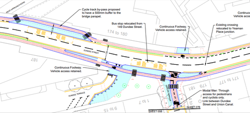
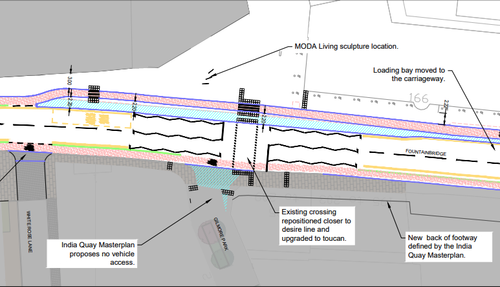
Looking at the technical drawings, starting from the West Approach Rd slip on page 8 and working eastwards;
Stop 1 (Eastbound) just after WA slip: 2.5m wide paved area without parallel footway, so entire bus waiting area is 'floating'; I have to cross to reach the bus stop not cross to reach the bus;
Click image to see bigger
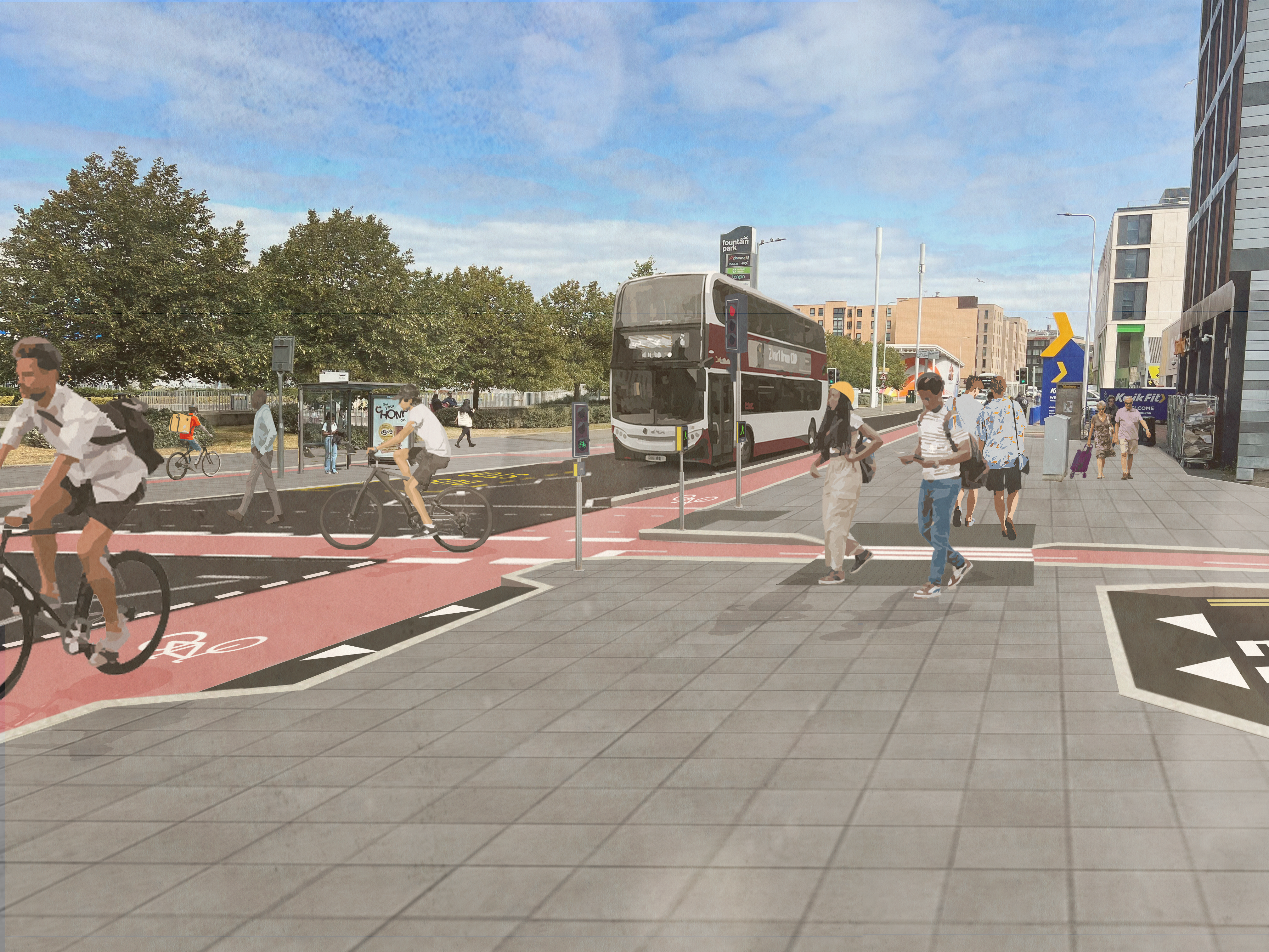
Stop 2 (Westbound) just over the road from stop 1: looks to be a similar size. There is footway space here that one might wait at; there is no indication of where the bus shelter will be. It could be reasonably inferred from Stop 1, and also from the composite image below showing a shelter on the 'floating' footway, that shelters throughout the scheme will consistently be placed on the floating bit, meaning again I cross to the waiting zone, not to the bus.
Click image to see bigger
Stop 3 (Eastbound) has an indicated width of 2.2m and is the stop pictured in the composite above, again indicating that the island is intended as a waiting area not merely for boarding;
Click image to see bigger
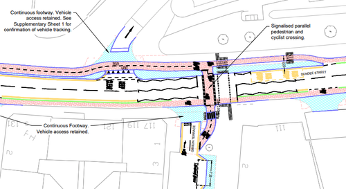
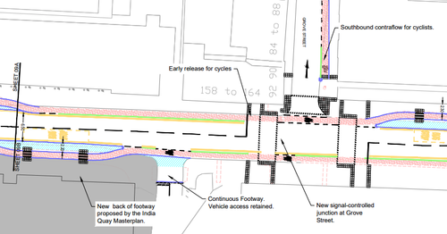
Stop 4 (Westbound) is a width of 2.2m at its widest point, however has a lot less waiting space in terms of the length it runs for, with tapers at both ends. I would anticipate more crossing to be necessary here when bus passengers are departing the stop than at the other stops so far;
Click image to see bigger
Stop 5 (Eastbound) is again 2.2m, and shares some of a more generous length with a toucan crossing. There is significantly wide parallel footway space also;
Click image to see bigger
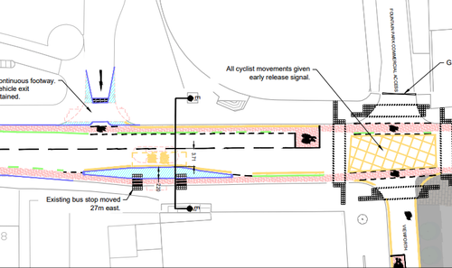
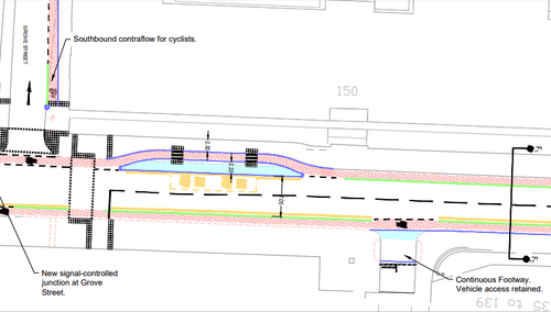
Stop 6 (Westbound) is unhelpfully split across parts of page 10, but still easy to see it's got quite a long waiting space available, at a width of again 2.2m;
Click image to see bigger
Stop 7 (Eastbound) again has a fairly long waiting area at 2.2m wide, but is notable for only having an accompanying footway of 2.3m at this point. This makes it even more likely that folks waiting for the bus will have already crossed to the island to be off the pavement space.
Click image to see bigger
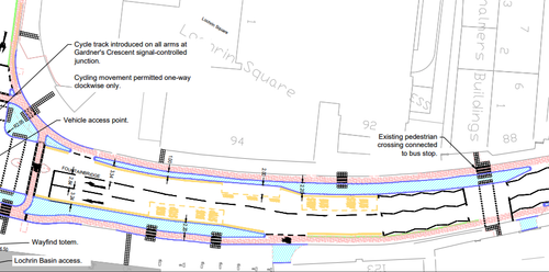
Stop 8 (Westbound) is significant in its island length (which runs all the way to the CYCLOPS junction at Lochrin basin), is again at a width of 2.2m, with two zebra crossings as per most of the bus stops in the scheme;
Click image to see bigger
Stop 9 (Eastbound, also pictured in the above) has a 2.2m island space twice the length of the marked stopping area for the bus on the carriageway, with a single zebra at the stop and a second zebra facilitating the connected pedestrian crossing at its eastern end. I'd actually like to see two zebra crossings here matching the rest of the scheme, at the blue markings below - as these match up with my expectation that buses serving the stop need a crossing at the driver's end for folks disembarking and catching it last-minute from the footway (yes, I acknowledge this scenario can actually happen and could mean an interaction with a cyclist, big gasp) and also a crossing at the other end, where assumedly the end of any queue for the bus would be.
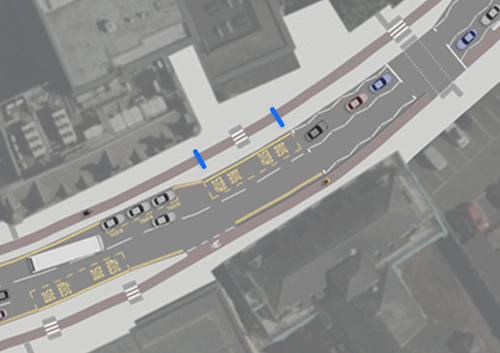
Click image to see bigger
My hope is that by numbering the stops and breaking them down into individual implementations, we can start working around this LSE 'floating bus stops bad' stuff with feedback about specific locations and potential improvements. I might turn this into an edi.bike article and start firing criticism at them publicly to move that conversation along, though I feel it's more to hold LSE to account than it will be likely to change certain minds.


 posts
posts
