CityCyclingEdinburgh Forum » Infrastructure

Path by the tram line?

(22 posts)

  1. crowriver
    Member

    Spotted from the train this morning, alongside the foundations for tram tracks just west of Murrayfield, and heading towards Saughton, what looks very much like a new cycle/shared use path. Nice smooth, fresh tarmac. Not entirely level like the tram tracks, but gently undulating. Skirts around the edge of the golf course.

    Could be good!

    Posted 12 years ago #
  2. chdot
    Admin

    Suspect you mean Carrick Knowe -

    http://edinburgh.cyclestreets.net/journey/1715493

    Useful, though crossing Balgreen Road likely to be an issue - don't think it's intended to keep the path going towards Murrayfield to join the WoL.

    Wonder when it will open for walk/cycling.

    Posted 12 years ago #
  3. crowriver
    Member

    Yes, that's the place. Brand new path, running parallel to the tram tracks on the north side.

    I imagine it won't open until the tracks are down (not yet) and a fence is erected to stop ramblers/dog walkers/joggers/cyclists from straying onto the tracks...

    Posted 12 years ago #
  4. cb
    Member

    I always wondered how that new path would join up to the road at the western end as there are houses in the way.

    But having just looked on Google Earth I see there is a handy dead end road going behind the houses from a little to the north.

    Obviously making the new tram bridge a little wider* to accommodate bikes would be out of the question.

    (*I assume that they haven't actually done this)

    Posted 12 years ago #
  5. chdot
    Admin

    "I see there is a handy dead end road going behind the houses from a little to the north"

    Yeah, complete with shared use signs!

    This new path has been coming for YEARS!

    Used to be possible to continue on rough track, but been shut off for a while.

    Posted 12 years ago #
  6. kaputnik
    Moderator

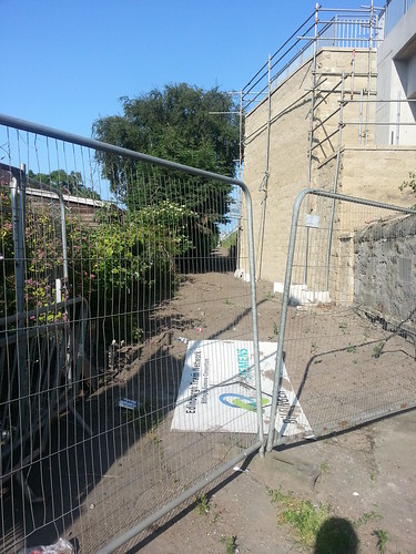
    I did a bit exploring on the way home last night to see what I could see of the new path.


    View from the footbridge at Carrick Knowe Avenue across the railway to Saughton Mains.


    This is the western end of the new path, just off of Carrick Knowe avenue.


    This is taken from Carrick Knowe golf course, looking down the beautiful new tarmac with Whitson on the right.

    This is as far as you can get down Carrick Knowe golf course, where the allotments start. the path continues on a little bit further to meet the Balgreen / Corstorphine path just behind the old Jenners Depository.

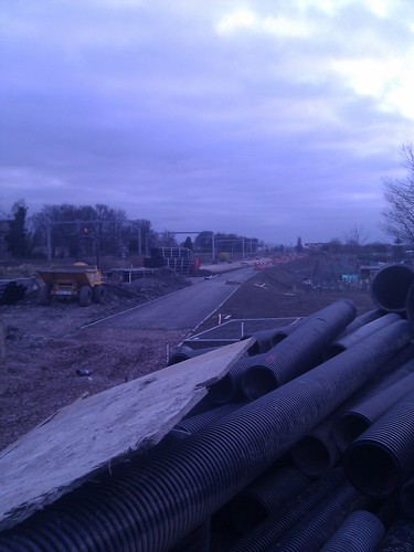
    Progress on a new shared-use, off-road path running between Carrick Knowe and Balgreen along the side of the tram line. It looks largely complete, let's just hope we don't have to wait until the tram is completed to get to use it.

    By the way, there's no path across the golf course - just a groove around the edge worn by dog walkers.

    Posted 12 years ago #
  7. crowriver
    Member

    Yeah, I meant to add yesterday that I had a shufty from the train again, examining more closely this time and the path is pretty level and smooth, not undulating as I thought initially. It follows the same plane as the tramline foundation, just slightly further up the slope.

    Posted 12 years ago #
  8. kaputnik
    Moderator

    The only real hump / wiggle is just beyond the fences in the second photo, over the shoulder of the embankment for the tram viaduct. Apart from that it's lovely flat and smooth all the way.

    Posted 12 years ago #
  9. wingpig
    Member

    Hope they're going to seed the surrounding mud before it gets washed across all the nice fresh tarmac...

    Posted 12 years ago #
  10. LivM
    Member

    Thanks for the photos, Kaputnik. I wonder if it's going to open before June? I'm leading a bike ride in that direction in June and it would be good to use it...

    Posted 12 years ago #
  11. kaputnik
    Moderator

    @LivD I was wondering if we'd have to wait until the grand tram opening in 2016 to get a shot. I'm sure once works have progressed a bit more the locals will re-arrange the fences to gain access. You can't build a desire line like that and then not expect people to want to use it.

    Posted 12 years ago #
  12. Uberuce
    Member

    2016? *sniggers at the optimism*

    Posted 12 years ago #
  13. D_Monkey
    Member

    I've been longingly watching this one take shape for a while, as I dodge the cars parked over the cycle cut-throughs at either end of Whitson Road, and get honked at every week for then turning right on to Stenhouse Drive, just to hold up traffic as I wait to turn right again onto the Stenhouse cycle path 20 metres later.

    The joy of a (slightly more) connected cycling infrastructure!

    Posted 12 years ago #
  14. cb
    Member

    East end of the path:


    East end of path by ccbb7766, on Flickr

    Posted 12 years ago #
  15. gembo
    Member

    I came down Corstorphine Hill today left on to st johns rd then right then left along west traquair then right through carrick knowe up and over the railway on the stepped bridge with its own cycle path then left through Stenhouse and into work. Took maybe ten minutes, had little idea of where I was going except general ideas of where I had gone wrong before. It was absolutely fab-u-lous darling.

    Posted 12 years ago #
  16. kaputnik
    Moderator

    Got bored of this path not being open, seeing as it seemed to be largely complete this time last year, so have emailed Le Tram to find out what they reckon.

    Posted 10 years ago #
  17. cb
    Member

    I can't help feeling that they surfaced the bike path a bit too early in the process.

    Hopefully the surface will have stood up to potential abuse all the nearby heavy construction vehicles moving about. I think that various heavy tram parts have been stored on the path at certain points too.

    Posted 10 years ago #
  18. kaputnik
    Moderator

    Indeed, I've a feeling it may have been compelted prematurely to use as a construction road. Whenever I've seen it from the train, it's usually been covered in spoil, excavators or Transit vans

    Posted 10 years ago #
  19. cb
    Member

    A year ago, up thread, chdot said:

    "don't think it's intended to keep the path going towards Murrayfield to join the WoL."

    I had never really spotted this on my way past before, but there is definitely a nice space for a path running alongside the tram line.

    Whether this has just been used as works access I'm not sure, but it would be a great path. Not sure if it was orginally railway land or gardens.

    I looked up one of the aerial photos from the Trams site and there seems to be an equivalent strip on the other side of the WOL leading up past the stadium.

    Posted 10 years ago #
  20. DaveC
    Member

    I have noticed the original path in this thread from the train if I come in this way and I can testify to some large puddles when it rains! And the path is not even open to the public yet! Bad design?

    Posted 10 years ago #
  21. cb
    Member

    Posted 10 years ago #
  22. cb
    Member

    And at the WOL end:

    Posted 10 years ago #

RSS feed for this topic

Reply

You must log in to post.


Video embedded using Easy Video Embed plugin