
The Water of Leith Management Plan is currently being prepared - public comments wanted by June 18th (lots of info here).
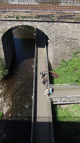
As anyone who has cycled the whole route knows there are a few places with potential for conflict between cyclists and pedestrians - notable around Dean Village.
The Draft Plan states that "The walkway extends from Balerno to the Leith Docks. The route is suitable for walking and cycling, and is partially accessible by wheelchairs and by horseback."
Presumably there is no intention to restrict cycling, the report clearly identifies issues to be managed -
"Management issues which were raised by these teams include the interaction between different users who travel at varying speed on the walkways (cyclists, pedestrians, horse riders), drainage and maintenance of gullies, access points to the walkway, and wild camping in Craiglockhart and Colinton Dell."
Banning things requires enforcement. As 'we' know from threads on this forum there are occasionally similar problems on the Union Canal caused by inconsiderate cyclists (and dog owners...), so anything than reduces conflict potentials and encourages sensible behaviour is welcome.
The draft document isn't merely about the WoL. It outlines the aspirations of the Access Strategy - "An integrated and inclusive network of routes for walking, cycling and horse riding which contributes to Edinburgh’s status as a world class city by ensuring that everyone who lives in, works in and visits the city can move around it easily and in a sustainable way"
In addition it highlights Edinburgh's Local Plan - "It also includes a policy (E26) to protect and improve rights of way and walkways, and states that the banks of the Water of Leith and Bavelaw Burn should be safeguarded for continuing recreational use. Policy E27* is specific to the Water of Leith and promotes continuous access along the banks of the river, protection of its landscape and rural quality, and management of the wildlife corridor.
(*Policy E27 - River Almond, Water of Leith and their Tributaries: The following measures for the protection and enhancement of the recreational potential of the River Almond, Water of Leith and their tributaries will be encouraged and supported: 1. the completion of continuous walkway/cycle routes along their banks, where appropriate, and the establishment of footpath links with adjacent sites; 2. the completion of a walkway/cycle route along the River Almond between Craigiehall/Cammo and the Queensferry/ Kirkliston walkway/cycle route; 3. protection of their exceptional landscape qualities and rural character, and improvement of degraded sites adjacent to the River Almond between the airport and Newbridge; and 4. the sensitive management of their banks and defined valleys to consolidate and enhance their value as wildlife corridors.)
All good stuff - just needs some implementation...
As WoL users, it will be worth commenting on the the Plan - if only to say that you value the Wol Walkway and look forward to it be improved! Comments to sue@suebellecology.co.uk by 18th June 2010.
 posts
posts
