
Lochend viaduct coming from the 'butterfly'? Taken presumably from the Restalrig path?
CityCyclingEdinburgh Forum » Infrastructure
NEPN - some history
(43 posts)-
Posted 8 years ago #
-
Good find, K. Michael Laing had a better camera than me, five years before I photo'd almost the same view:
and then 2009:
Posted 8 years ago # -
Not the NEPN though!
Needs a connection...
Anyone got 'previously' pix of Five Ways?
(Some here - https://www.railscot.co.uk/locationnew.php?loc=Trinity%20Junction)
Posted 8 years ago # -
 26032 Trinity Jct A_NEW by Alan Rintoul, on Flickr
To help orientate, the train is just coming out of the Trinity Tunnel. The E-W route from Pilton to Leith ran over this route at the bridge level, now lowered down to form 5-ways. Fork to the left is the Chancelot Path, fork to the right the Warriston / Goldenacre Path.
 Trinity Junction by Alan Rintoul, on Flickr
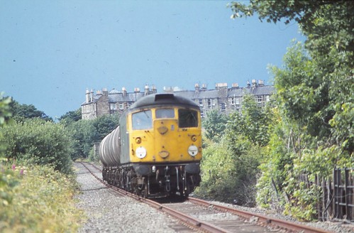 Cl. 26 Powderhall Sept 80-p18n151anqpqr152fdu0128pe35 by Alan Rintoul, on Flickr
Posted 8 years ago #
Cl. 26 Powderhall Sept 80-p18n151anqpqr152fdu0128pe35 by Alan Rintoul, on Flickr
Posted 8 years ago # -
Good find.
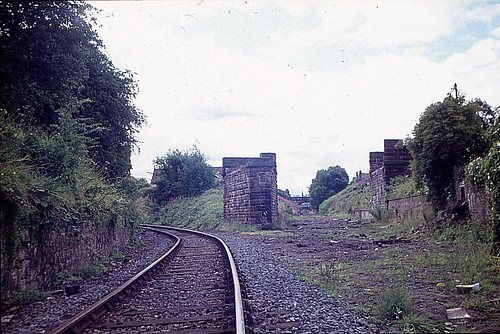
Can't remember when that bridge was removed.
(Exactly the site that is now Five Ways.)
Posted 8 years ago # -
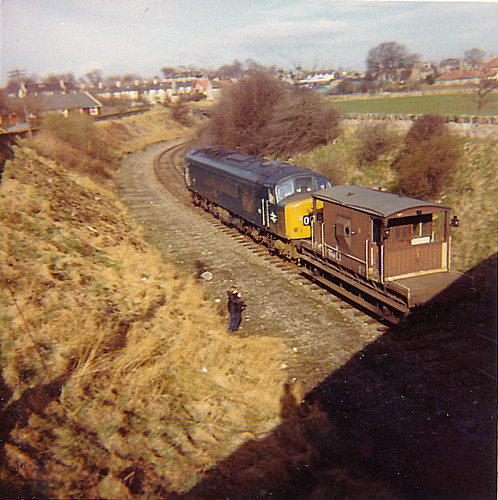
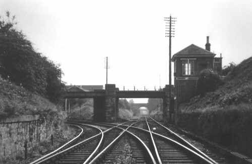 Trinity Junction looking North, September, 1967. (Collection of W D Yuill) by Kenneth G Williamson, on Flickr
the base of the signal box was there until fairly recently.
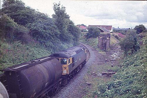
 175 Bangholm Apr 72 by Alan Rintoul, on Flickr
This photos is taken from the bridge over the Chancelot Path that gives access to the Bangholm Recreation Ground (fields on the right), looking north towards fiveways, the Pilton - Leith route runs left-right across the photo in the middle distance where the line of houses is.
Posted 8 years ago # -
@Kaputnik that's a great picture from 1967, but just as a question of orientation, shouldn't the label say "looking South"?
Posted 8 years ago # -
@ih yes the caption is wrong, it's looking south with the tunnel to the north behind the photographer.
Posted 8 years ago # -
1967 picture is a peculiar junction by modern standards. Having the down line merge into the single line over a double junction doesn't convey any benefit compared to a crossover to the up and a single turnout.
I would suspect it was left this way after a singling job on the cheap.
As shown, assumed line direction (London up):
.....| single

.....|

..../|

d../ |

.\ | |

u \| |

.\ |\|

..\| |

...| |

up     down
Modern arrangement (best guess):
d

.\...| single

u \..|

.\ \.|

..\ \|

...| |

...|/|

...| |

up     down
The latter arrangement can be seen (in reverse) at Ladybank in Fife.
edit: I drew these nice diagrams but chdot's code tag doesn't respect multiple whitespaces so i needed to add all those ugly dots
Posted 8 years ago # -
@Klaxon I think it would have been the "singling on the cheap" option. The straight-ahead line there leads only to the short dead-end stub to Scotland Street goods & mineral yard and Heriothill mineral yard, traffic would have been very light on this line for a long time by 1967 restricted to domestic coal deliveries mainly. The junction was originally singled between the 1876 and 1893 OS Town Plan surveys (see http://maps.nls.uk/geo/explore/#zoom=18&lat=55.9741&lon=-3.2023&layers=73&b=1) probably not long after the Abbeyhill Diversion loop was built as the main access to Granton. The running line to Scotland Street was still doubled in 1893, but the junction singled as per your diagram above, as was the next junction south at Warriston. I suspect it was left double track to act as a passing / holding loop for traffic waiting for access to Granton docks.
The primary route in the 1967 photo is that curving off left towards Powderhall / Leith Walk / Lochend and would still have been quite busy at this time.
Posted 8 years ago # -
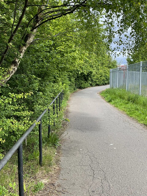
Just revising this thread as I am using a fair bit of the NEPN fairly often these days.
Mostly Haymarket to Trinity also up to St. M & K G Parks.
Vegetation encroaching at ground, shoulder and head height, reducing effective width a safety/sight lines. P
This is not new, but very noticeable at this stage of a new growing season.
Also various places where the surface is beginning to show its age.
When the main part of the NEPN was constructed it was decided by (then) LRC to construct it to ’road standards’ ie with good foundations under the tarmac.
That decision was down to Phil Noble who continues to do valuable/important work at CEC.
A long time ago, Sustrans did a report with recommendations for ‘vegetation management’s. This recommended significant cutting back/tree felling.
This was not universally welcomed, but the current lack of maintenance is presumably not due to ‘prioritising
wildlife’ but lack of resources/money. Also (probably) because no one is really responsible - at least in Transport/Active Travel sense.

No doubt the uncertainty over the possibility of the tram using the Roseburn Corridor is part of the problem.
But…
Posted 3 years ago # -
To reply to a 5 year old post, Klaxon and kaputnik...
> 1967 picture is a peculiar junction by modern standards
It could be a singling done on the cheap but you also have to remember that facing points (ie points which diverge in the normal direction of travel of trains) were (and still are, to some degree) considered a necessary evil on the mainline railway. Some companies were more fanatical about this than other leading to some rather odd layouts. This would seem like a fairly simple way of at least pushing the facing points off to a 'siding' rather than forcing them to be on the mainline.
Posted 3 years ago # -
Towards the end of this section being used as a railway - maybe a weekly tanker train to Granton - maintenance was minimal/non-existent.
A train split the track and derailed between the tunnel and Powderhall.
Posted 3 years ago #
Reply
You must log in to post.
 posts
posts
