Of course this is going OT CCE style.
The way Edinburgh is today depends a lot on the fairly recent past and in many cases due to 'campaigning' - and even "protests" with all sorts of local and city-wide groups involved.
After the 2nd World War there was a big push for 'modernisation' of cities. This was necessary in places that had been heavily bombed.
Not Edinburgh then.
Though of course in many places in Continental Europe the past was rebuilt.
The 'visions for the future' usually involved tower blocks and big roads.
Edinburgh got its version around the Calders. Is there any real justification (in traffic terms) for the continuation of the dual-carriageway and scary roundabouts??
In the centre the 'civic bombing' was based on "slum clearance".
This obviously wasn't a new phenomenon. Overcrowding and insanitary conditions in the Old Town led to the creation of Craigmillar - a settlement with a similar population to Musselburgh with high quality houses but not the number and range of shops etc. as an organically evolved town.
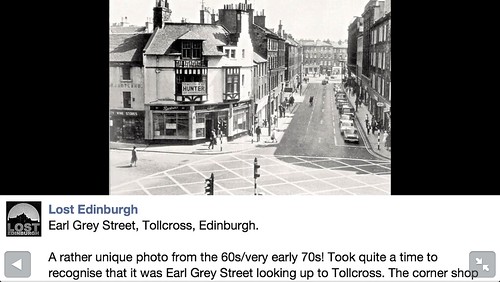
Tollcross and the South Side suffered from "planning blight" due to various road plans (including The Bridges Relief Road) and expansion plans of both the University and Royal Infirmary).
Then the 'mood' changed and the idea of 'people living in the city centre' was boosted by new sources of money for rehabilitation and new-build.
"
This change in Planning policy, allied to the availability of private sector grants and the promotion of Housing Association activity, produced a burst of residential rehabilitation activity throughout the South Side. This started in the mid 1970s and continued through the 80s and had the effect of restoring confidence in the South Side. The single biggest scheme was the partial restoration and rebuilding of a full street block on Nicolson Street between East Crosscauseway and West Richmond Street, which included ground floor shops and a supermarket. Edinvar Housing Association also made significant inroads into refurbishing blocks on Buccleuch Street, Drummond Street and Drummond Place.
During the same period, the City Council and Housing Associations began extensive new build housing schemes along the Pleasance and St Leonard’s Street where clearance had taken place for the now deleted Bridges Relief Road.
"
http://www.edinburgh.gov.uk/download/downloads/id/1455/southside_conservation_area_character_appraisal
Since then there has been more interest in cycling and cycle infrastructure and, peripheral, pedestrians and their less than ideal facilities.
Perhaps we are at point where 'the future' can be one where peds and bike aren't increasingly expected to "share", and a serious attempt is made to reallocate road space??


 posts
posts
