CityCyclingEdinburgh Forum » Infrastructure

List for Lesley

(56 posts)

No tags yet.


  1. dg145
    Member

    I tend to vary it (on those days when I'm not just getting the train from Embra Park):

    Quickest is along the Broomhouse Path and then up South Gyle Access and South Gyle Avenue, straight out via Gogar Roundabout. But that's also the busiest in terms of traffic and even with filtering you can get caught up in rush hour traffic snarls.

    More recently, and probably today, I'll head up the Broomhouse Path to just before the train station then cut off through Edinburgh Park (utiliing the shared use path at the traffic pinch points) and then across that clunky bit at the end of the by-pass ... then the joys of the roadside path/pavement along to Newbridge and on to the wild hinterlands of West Lothian.

    Posted 10 years ago #
  2. calmac
    Member

    @dg145 I live in Linlithgow and I sometimes cycle home - don't have the fitness or energy (or morning spirit) to do it on the way in.

    From the Newbridge flyover it's generally a great cycle - path to the wee road to Winchburgh, follow that until I hit the canal, short section on that which saves a dog-leg, then up the hill to the juntion in Winchburgh and along the reasonably wide road to Linlithgow. I'm sure that road is wide enough for cycle lanes either side... well, a man can dream.

    But getting from the Broomhouse path to Newbridge is really rubbish. When you think that it's one of the half-dozen most important routes into Edinburgh, it's really not good enough. If car drivers had to put up with this guff there'd be a revolution.

    Posted 10 years ago #
  3. chrisfl
    Member

    As others have said the 2 routes into Edinburgh Park from Broomhouse path are either to go up South Gyle Access and then go left onto South Gyle Crescent, although this is a busy route. I do see some cyclists going along the pavement and then across the path and via Flassches Yard which skips the roundabout.

    Interestingly I was going that way this morning and following a line of traffic behind another cyclist, counted every single car overtaking properly with lots of room!

    The other way in is to follow the path up to the train underpass just before the station, avoids all the traffic, but if there's a headwind I tend to turn off earlier.

    Also worth ranting about the link between the canal and Edinburgh Park down Cutlins Road, following the canal out of town is a great route for people finding there feet(or wheels) on bikes. But it's let down by what is sometimes a terrifying road with Concrete lorries, Tesco Vans, Royal Mail artics and car deliveries.

    Posted 10 years ago #
  4. Nelly
    Member

    "link between the canal and Edinburgh Park down Cutlins Road"

    Is the pavement not shared use?

    Posted 10 years ago #
  5. chdot
    Admin

    "Is the pavement not shared use?"

    Only the bottom bit.

    Posted 10 years ago #
  6. Nelly
    Member

    chdot, I don't go up that way often but that must be rather confusing - does that mean......potentially....use shared pavement, cross onto road, up road, cross road again then onto pavement before joining canal path?

    Dear god there is no chance if that is perceived to be in any way sensible.

    Posted 10 years ago #
  7. chdot
    Admin

    Haven't been for a while.

    That sounds about right, (I mean 'correct') - only the reality is worse - surface, hill etc.

    Posted 10 years ago #
  8. gembo
    Member

    Lot of parked cars on the way down that hill and a right turn that vehicles take about half way down. So some folk come off the canal and use the grass, others use the pavement, others risk it on the road.

    The last third on the way down is a bit easier as it is technically one way and two lanes, the right one only for bikes or buses, of which there do not seem to be any.

    Thus on the way up if you are not on the pavement you are technically going the wrong way up a partial one way street. Polis lifted me for that (though when in van six other cyclists went part and polis let me go with stern word). After the one way bit road is ok as cars can't come up. You then ususally have some right of way over the cars coming from the industrial estate on your left, only really tricky when trying to get on to canal at top.

    Agree few options for the inexperienced. Also travelling west on canal tricky to find good route. Maybe come off where the wester hailes Tesco used to be and cut down to Murrayburn and across or under the Calder road to the Stenhouse path. That isn't easy.

    You could come off canal at WHEC and take the main road but that is not nice either.

    Posted 10 years ago #
  9. Snowy
    Member

    @chrisfl That's a good point about the use of Flassches Yard. Interestingly when going from the Broomhouse Path to go under the bridges into South Gyle Access, the signs on the black obstacles posts are for a shared use pavement from that point on. But, crucially, they are never cancelled...so in theory it's a shared use pavement all the way along to the cut through to the Flassches Yard path or even to the roundabout...

    Posted 10 years ago #
  10. calmac
    Member

    Had to google Flassches Yard. Ta, a very handy wee link!

    When cycling into the centre of Edinburgh from home I come off the A8 path at RBS and go along Gogar Station Road, from there you can join the canal just after crossing the motorway. This route is usually very quiet - miles better than Cultins Road.

    There's an underpass from Lochside Road near Edinburgh Park station through to Gogar Station Road, but it's a bit of a dog-leg. Handy for getting to/from the quiet roads between the A8 and M8 though.

    Posted 10 years ago #
  11. chdot
    Admin

    "Flassches Yard"

    Has it always been called that?

    Know the cut-through BUT -

    Are the links shared use?

    (I think not!! - paths c/should be much wider.)

    Dropped kerbs at SGA?

    I think median strips were introduced to stop parking - more effective than yellow lines.

    Must be other places this could be done...

    I presume this is a private road(?)

    Posted 10 years ago #
  12. calmac
    Member

    @chdot According to CEC website it's private.

    On google streetview, a cyclist follows the camera car down the road. No helmet and carrier bag on the handlebars. Shocking.

    Posted 10 years ago #
  13. cb
    Member

    "There's an underpass from Lochside Road near Edinburgh Park station through to Gogar Station Road, but it's a bit of a dog-leg."

    ...and a more direct, but rougher/muddier route a little to the north, running along the north side of the Stinkin' Chickin* farm.

    *As named on OSM.

    Posted 10 years ago #
  14. Snowy
    Member

    Yes actually..there are dropped kerbs at SGA Pelican crossing. Due to the ambiguous nature of the aforementioned signage, it seems fine to proceed 50 metres north on the 'shared use' pavement and then up a 20m path to Flassches. The cul-de-sac end of Flassches has a wide dropped kerb from the path to the roadway and a couple of decently spaced bollards. It then pops you out on South Gyle Crescent with good sightlines, thus avoiding a very nasty roundabout. It could have been deliberately built for cyclists! (If it's a private road, I hope the irony is not lost on CEC)

    Posted 10 years ago #
  15. kaputnik
    Moderator

    Emailed to Andrew and Lesley...

    9 Months Inaction by the Magnificent Octopus, on Flickr

    Posted 10 years ago #
  16. chdot
    Admin

  17. chdot
    Admin

    Path removed in Inverleith Park.

    Posted 10 years ago #
  18. chdot
    Admin

    Tram Depot Entrance

    Posted 10 years ago #
  19. chdot
    Admin

    Meadows to Innocent cycle route (Ongoing - initial plans greatly revised.)

    Posted 10 years ago #
  20. chdot
    Admin

  21. SRD
    Moderator

    Stickman posted this above a year ago. "The crossing at Balgreen Road at the end of the new cycle path being a Pelican and not a Toucan." Someone mentioned it again, here or on Twitter, so I emailed and was told that they are procuring a design for this and hope to implement it in 2016/17.

    Delay caused by staffing issues. The email also mentions 'access/egress' to Baird place - can you say 'shared use pavement' ?

    Posted 9 years ago #
  22. neddie
    Member

    The crossing at Balgreen Road at the end of the new cycle path being a Pelican and not a Toucan...

    ...they are procuring a design for this and hope to implement it in 2016/17

    What?

    All they need to do is change the button-push faceplate covers so that they display a green man plus a green bicycle, instead of just a green man.

    It should cost around £20 and be a 5 min job. Really isn't difficult.

    If this is CEC's glacial pace of change, I'll be dead before even the NEPN is connected to the canal and meadows.

    Posted 9 years ago #
  23. They put a wee sign up some time ago for cyclists coming off the Balgreen tramstop path that says 'Use the crossing', so they probably reckon that will buy them at least ten years breathing space before they have to put a Toucan in.

    In the meantime, we'll still get dirty looks, comments and abuse from drivers and pedestrians for cycling over a 'pedestrian' crossing.

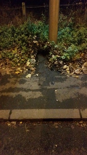
    Posted 9 years ago #
  24. acsimpson
    Member

    Maybury Road is sorely missing any cycle facilities. There is plenty space for a segregated lane along 90% of it's length but instead cyclists are given the unenviable choice of mixing it with speeding traffic or riding on the heavily overgrown pavement.

    It should be a really easy win for the council to improve matters, meanwhile it keeps getting busier.

    Posted 9 years ago #
  25. HankChief
    Member

    @ac on my way home on the East pavement tonight and witnessed 2 cyclists on the West pavement trying to pass each other - very tricky it was too on the narrow footpath.

    I went over to have a closer look and with a bit of use of my right boot discovered more than 2 foot of pavement hidden underneath accumulated dirt.

    Maybury Rd West side. 2ft of dirt narrowing pavement by HankChief, on Flickr

    So I've sent a tweet to the westteam et al in the hope someone will clear it back...

    Posted 9 years ago #
  26. chdot
    Admin

    Just a reminder

    Now we are about to have a new council, might be worth starting a new list…

    Posted 2 years ago #

RSS feed for this topic

Reply

You must log in to post.


Video embedded using Easy Video Embed plugin