CityCyclingEdinburgh Forum » Debate!

John Muir Way - thoughts

(26 posts)

No tags yet.


  1. chdot
    Admin

    The John Muir Way project is complete - though no doubt there are signs to be added or revised.

    Long distance 'themed' walking/cycling routes are not new - and more are coming. The reasons behind them will be a mixture of encouraging people to discover 'the great outdoors', devising a nice/sensible/challenging route that can be followed in sections or 'end to end' - helped by good signage - just for fun or as part of a serious tourism plan.

    The JMW is slightly unusual as it has recommended/signed alternatives for cycling in some places. Some people will only follow the 'cycle route' others will follow the 'walking' routes - especially if they look more interesting.

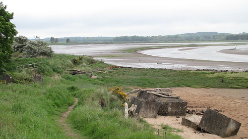
    Last week I tried some sections in East Lothian. The first (walking) bit going east from Dunbar included a bit too much sand and too many steps for my liking, but the 'walking' route from Bellhaven to East Linton, along the coast and up the Tyne was delightful.

    The signing is much better than a lot of Sustrans routes though the path is very narrow in places and if it had been created by Sustrans as a cycle route would come in for a lot of criticism!

    Fortunately in Scotland such paths are available to bikes for 'responsible use'. There have always been people willing to use paths on bikes - especially since mountain bikes became popular, but there must be plenty of scope for new routes that are perfectly cyclable without being particularly wide or tarmac/whin surfaced.

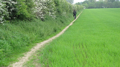
    I was particularly impressed with a path along a field margin - presumably a longstanding Right of Way. Presumably there is also some agreement where the farmer doesn't just 'forget' about it and plough right to the edge of the field.

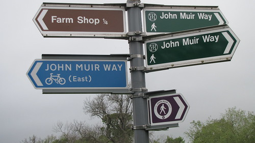
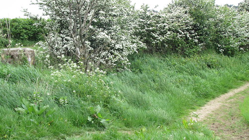
    This is one of the few signs that is 'easy to miss' -

    Posted 10 years ago #
  2. chrisfl
    Member

    I really want to get out and try some of the route, in the meanwhile I've written a small blog post with some GPX files extracted from OpenStreetMap to help those trying to Navigate, as well as links to some other maps.

    http://chrisfleming.org/OpenStreetMap/john-muir-way/

    Posted 10 years ago #
  3. firedfromthecircus
    Member

    Sorry in advance, but here are my thoughts.

    The new John Muir Way(s) in East Lothian is a typical example of people with no clue having an idea and then implementing it badly.

    The old JMW had some really nice bits to cycle, along with some sections that were not ideal, especially for familys. The effort should have gone into improving those areas by changing gates etc, and the occasional area that needed re-surfacing. And keeping it as one route.

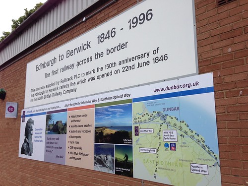
    Now that they have the cycle route they have spoiled some of the footpath parts by putting in more non-cycle friendly gates. The cycle route has some truly awful diversions from the footpath route, where the footpath route would be far preferable to cycle on than the new cycle route, and most of the cycle route is on roads that in a lot of cases are not family friendly. They have also cut both routes short at Dunbar, so now there is no link down to Dunglass/Cockburnspath and the start of the Southern Upland Way. And they spent all the money on an array of gaudy signs that clutter up the countryside instead of some decent facilities. (your picture illustrates perfectly)

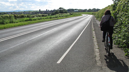
    And while I'm at it, if you cycle a Trike, velomobile, handcycle etc you might have fun on certain sections with bollards and narrow paths, some of which are within inches of 60mph roads where everyone does 70mph.

    Posted 10 years ago #
  4. chdot
    Admin

    What are you apologising for!?

    It's good that you are able to do before/after.

    "some of which are within inches of 60mph roads where everyone does 70mph."

    I got that impression from looking at the map, so chose the 'walking route' and found it mostly rideable - and nice, but not much use for 'interesting' bikes -

    But in places the walking route is the same as the cycle route (or maybe that is the road?)

    I was hoping to select sections using CycleStreets, but I suspect that some sections have been tagged 'no cycling'.

    Perhaps this is 'necessary' to discourage 'ordinary' cyclists(?)

    Posted 10 years ago #
  5. Baldcyclist
    Member

    Is the route well sign posted?

    I need to get from Edinburgh Uni to QMU tomorrow for a meeting and to be hones have never cycled anywhere east of the commie pool in Edinburgh. It would be easy for me to get lost...

    Posted 10 years ago #
  6. kaputnik
    Moderator

    We walked up Kaimes Road on Saturday and were amused to find it signed as part of the John Muir Way. I'm not sure john Muir was that into early 20th century suburban sprawl?

    Posted 10 years ago #
  7. SRD
    Moderator

    It's fairly straightforward. Balanced route/quiet route should get you there.

    Not sure how signposted the turn off at brunstane is (we did that as a part of a loop in the opposite direction).

    http://edinburgh.cyclestreets.net/journey/42285021/

    Posted 10 years ago #
  8. amir
    Member

    That cyclestreets route is a little odd as it skips off the Innocent and back on.

    Following the signs is not too bad but keep your eyes open!

    You can just follow the Innocent to the underpass at the end of the railway section. Then either go over the footbridge by the big store called the Range (you have to carry the bike) or simply buzz left round the store along a footpath and onto Brunstane Rd South. As you go into the Gilbertoun estate watch out for the signs. These will take you onto another ex-railway path for 0.5km or so (the first part may be a bit rough - possibly to bypass but not signposted). At the end of this there is a sharp drop onto a main road Newcraighall where you need to turn right. Shortly before you'd go under a railway bridge, insted turn left into a small estate and keep right until you see a small car park - go through this onto a path and up until you get to QMU.

    There are short cuts but you're probably best ignoring these unless you're confident with navigation.

    Posted 10 years ago #
  9. SRD
    Moderator

    "That cyclestreets route is a little odd as it skips off the Innocent and back on."

    have flagged that to them and had a reply back - they've fixed it but it will take a while to take effect.

    Posted 10 years ago #
  10. chdot
    Admin

  11. chdot
    Admin

    If you don't want to slavishly follow JMW from Ed, there are alternatives -

    http://citycyclingedinburgh.info/bbpress/topic.php?id=13569#post-174395

    Posted 9 years ago #
  12. LaidBack
    Member

    BBC Out of Doors did the cycle over four days....

    Radio here:

    http://www.bbc.co.uk/programmes/b04vf01d

    Critical in places... in an entertaining way.

    Repeat from earlier in year.

    Posted 9 years ago #
  13. chdot
    Admin

  14. gembo
    Member

    Interesting route once gets to water of leith. Not sure why doubles back instead of going on down to Stockbridge for example?

    I was out walking on the thieves road today from little vantage on the a 70 over to west Linton. New path also now constructed that takes you to Kirknewton. Bit wet. Lots of bikes on Whang and one intrepid mtb fellow on the thieves road, alas with a puncture.

    Posted 9 years ago #
  15. dougal
    Member

    BBC programme starts at 36 minutes if you want to cut to the action. Before that is half hour about Tom Weir.

    John Muir bit included interview with my former headmaster. I had never considered that John Muir went to the same school as me (though at a different site). The current secondary school's website is a bit short on historical information but the 1997 school centenary document has some interesting information for the historically minded.

    Posted 9 years ago #
  16. SRD
    Moderator

    "Before that is half hour about Tom Weir."

    anyone else get woken up by 'Tom Weir and his anorak, anorak, anorak' this morning? thanks recombodna! great start to the day ;)

    Posted 9 years ago #
  17. cb
    Member

    Wait, what?! recombodna is in Aberfeldy?

    Posted 9 years ago #
  18. gembo
    Member

    Yes and he has a van

    Posted 9 years ago #
  19. Baldcyclist
    Member

    Thought there was thread for this.

    I'm nearning the end of my quest to (mostly) walk the John Muir Way, some thoughts so far with 3 stages to go.

    Most of the route I think is more suited to cycling than walking.
    Helensburgh to Balloch looks like a good walking route - although the walking and cycling routes are differnt, a MTB or Gravel bike would manage. I'm doing this route on Sunday

    Balloch to Strathblane. This is great walking route, with views looking back over to Ben/loch Lomond and the Arochar Alps, and then onto the Campsie's from the Kilpatrick hills. Though is very long at 30km, my feet and hamstrings were sore for 4 days afterwards. Strathblane is really difficult to get to by public transport, and we had to take two cars to do this, dropped mine off at Strathblane, and Mrs B and the boy, picked me up and dropped me off at Balloch where they spent the day.

    Strathblane to Croy. I'm going to do this on bike on Saturday. Strathblane is really difficult to get to by public transport, so I'll drop car off at Croy and ride there and back. Follows cycle path, and then Canal.

    Croy to Falkirk - Nice we wander up to the Roman fort at Croy and along the Antonine wall, then canal path most of the way to Falkirk.

    Falkirk to Linlithgow - Nice walk through Calander woods then, more canal path, nice wee wander through the woods into Linlithgow. By this point I was sick of canal path, and the endless monotony of it. Would have been pleasant to blitz on a bike.

    Linlithgow to S Queensferry - over the hill onto the Forth, then along the cycle rout to Queensferry. Not a bad walk.

    S Queesnferry to Edinburgh - Part cycle route, and part canal path, nice detour over Chorstorphine hill, but route is longer thank it needs to be.

    Edinburgh to Prestonpans - mostly cycle route. Nice walk once you get out of Edinburgh.

    Prestonpans to North Berwick - Basically on a tiny track alongside the road until Haddington, after that walk was lovely. Be good on a bike.

    North Berwick to Dunbar - still to complete.

    I've used the Walkhighlands route for the most part:
    https://www.walkhighlands.co.uk/john-muir-way.shtml

    In summary, with the exception of the first two stages, I think it would have been better done by bike. The central sections especially along mile after mile of concrete canal path are soul (and feet, and shin) destroying, and the transport link issue to Strathblane anoying.

    Could be done in two or three stages easily by bike with easy public transport links, I'd recommend:
    Hellensburgh > Croy.
    Croy > S Queensferry or Edinburgh
    Edinburgh > Dunbar if going by bike,

    First stage would be very hilly though, but I would advise going the walkers rather than the cycling route for the views and taking an off road bike. :)

    Edit: Also not enough strategically placed benches/large rocks for rest. :/

    Posted 3 months ago #
  20. fimm
    Member

    Prestonpans to North Berwick - Basically on a tiny track alongside the road until Haddington, after that walk was lovely. Be good on a bike.

    I don't think you mean Haddington...
    North Berwick to Dunbar - still to complete.

    Mr fimm has done this and says it's nice. I think he ran it, but maybe he did it by bike on another occasion as well.

    Incidentally if you can sort out transport to Cockburnspath I believe the Dunbar to Cockburnspath link is nice too, all along the coast.

    Posted 3 months ago #
  21. Baldcyclist
    Member

    "I don't think you mean Haddington..."

    Indeed, Gullane, don't know why Haddington was in my head. Becomes a nice walk when you turn off the main road just before Saltcoats castle. :)

    Posted 3 months ago #
  22. neddie
    Member

    Sadly, there is a missing link for safe family cycling from Edinburgh to N Berwick.

    Heading East at Lyars Rd, Longniddry, the A198 becomes full of horrible, impatient, speeding, noisy, angry drivers for about a mile until the road turns inland by Harestanes Burn.

    From there, you can take the cycleable path through the trees by Craigielaw golf course and parallel to the road, shielded from terrible drivers by a stone wall and the trees...

    Such a shame - I really want to do this route with the kids, but can't because of that section

    Posted 3 months ago #
  23. Frenchy
    Member

    I've had some horrific experiences on the section immediately west of that bit as well - from Seton caravan park to Lyars Road.

    Posted 3 months ago #
  24. neddie
    Member

    Yeah, the pavement is shared-use up to Dean Rd, but between Dean Rd and Lyars Rd can also be horrific

    Posted 3 months ago #
  25. Baldcyclist
    Member

    Did Croy - Strathblane - Croy with the boy on Saturday. Nice wee pedal on the MTB, though pushing (both bikes as boy couldn't) bikes up Bar hill wasn't a barrel of laughs, and also 5 padlocked gates which required bike chucking not the most fun.

    After that though it was canal path to Kirkontilloch, then cycle path to Strathblane. We were stopped at a junction in Kirkontilloch doing some route finding and Kirkontilloch seems to have its own chdot, older gentleman all in black on 70s/80s bike obviously seen enough 'tourists' to just ride by pointing in the required direction to the opening of the cycle route. A thank you was directed in his direction but he was probably already out of ear shot by that point.

    It was the boys longest ride at 29 miles (and a bit far on an MTB for me TBF, skinny tires would have been better). He struggled on the way out against the wind, and a very slight uphil imperceptible gradient. He flew back with the wind and slight downhill and was full of beans for it. He's now asking when we can go on our next adventure. :)

    Section 1 from Helensburgh, didn't do that on Sunday due to poor weather, but so e research suggests a lot of downed trees makes the route impassible. There is a diversion in place which follows the 3 lochs trail, or some heather bashing along side the Forrest probably will do.

    Anyway weather looks good for the weekend so John Muir Way back on pause as the hills call again

    Posted 2 months ago #
  26. cb
    Member

    The obvious (on the map anyway) alternative to that dodgy bit of the A198 is to go through Gosford House grounds.

    Of course they say that cycling is not allowed. They also tell you to follow the Scottish Outdoor Access Code which in turn says that cycling is allowed...

    Posted 2 months ago #

RSS feed for this topic

Reply

You must log in to post.


Video embedded using Easy Video Embed plugin