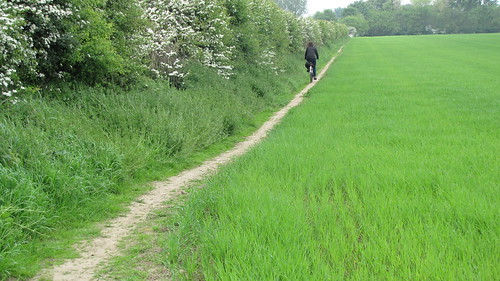
A thread for looking at the new 'path network' - particular where the 'walking sections' are (or not) suitable for cycling - though not always for trikes and trailers(?)
CityCyclingEdinburgh Forum » Leisure
John Muir Way (East)
(10 posts)-
Posted 11 years ago #
-
The section of JMW where it passes Kinneil Halt in Bo'ness is currently being upgraded.
I can't recall exactly what it was like before, probably hard-packed whin type surface, but it seems to be getting widened with a kerb either side which might suggest tarmac will be going down.
Potential for re-routing NCN 76 onto the JMW in places?
Posted 9 years ago # -
On OSM, NCN 76 seems to take 2 different routes between Blackness and Bo'ness:
https://www.openstreetmap.org/#map=14/56.0069/-3.5546&layers=C
Posted 9 years ago # -
Has anyone been on the "NCN" between Blackness and Bo'ness recently-ish?
The only time I've ever done this was years back and it was serious cylocrossing in places with much portage.
I was wondering if it's been improved at all as part of JMW and if one might venture down it on an Elephant Bike.
Posted 8 years ago # -
I do this regularly. Apart from a bumpy car park, the first 2km W of Blackness is perfectly tarmaced. Then you hit about 1km of stony and then back to tarmac for the last bit to Bo'Ness
can ride my hybrid over the 1km party- it is a bumpy ride, but no worse than other parts of the route e.g. around Hopetoun House. If Elephant bikes are as good as one member of this parish claims, it should be able to handle that part.
It is a lovely bit of path with great views of Blackness castle and the bridges
Posted 8 years ago # -
I'm fairly sure I went along there on my road bike with 23Cs once, and survived.
This was two or three years ago, so I can't remember what the surface was like. I also can't be completely sure what route we took, but we started in Bo'ness and finished at Blackness. As far as I can see on a map there's only the one obvious route to take, and I definitely remember going along a beautiful tarmac path beside the shore, so we almost certainly went all the way on NCN76.
Posted 8 years ago # -
Excellent. Thanks for the updates both, it may be that we do not cycle this time but will certainly consider it for future trips to the choo-choos.
Posted 8 years ago # -
Walked from WOL visitor centre to GMA2 found myself on John Muiir Way. Went a bit Pete Tong at Murrayfireld with all the roadworks. Lovely after Roseburn Cliff.
Posted 8 years ago # -
Blackness to Bo'ness is generally all good or pretty good now. There was a very major path upgrade leading up to and not long after the opening of the JMW - involved full on sea protection and all sorts. There was ongoing work along the front at Bo'ness too which I've lost touch with. The NCN still takes an inland route at Bo'ness itself, but with a map all sorts of interesting variations can be achieved. At the other end don't forget the connection through Hopetoun House to Queensferry... again not bad surfaces, although not necessarily suitable on a road bike here.
Issues are a couple of very awkward gates in Hopetoun - to be completely avoided on a tandem or with a trailer. You can see them mapped here:
https://osm.org/go/evfEjjVbF-?m=&node=31708994
https://osm.org/go/evfEL9lck-?m=&node=1906960911
(I don't remember if the second is as difficult as the first - which is definitely an issue)Also I hear rumour of some potential forestry work in Hopetoun. Details were very sketchy but suggested potential for path closures.
Posted 8 years ago #
Reply
You must log in to post.


 posts
posts
