"small cycling wins" brainstorm site
https://www.cyclescape.org/groups/6-edinburgh ?
Useful place to keep a record of issues, but I don't think the council look at it.
CityCyclingEdinburgh was launched on the 27th of October 2009 as "an experiment".
IT’S TRUE!
CCE is 16years old!
Well done to ALL posters
It soon became useful and entertaining. There are regular posters, people who add useful info occasionally and plenty more who drop by to watch. That's fine. If you want to add news/comments it's easy to register and become a member.
RULES No personal insults. No swearing.

"small cycling wins" brainstorm site
https://www.cyclescape.org/groups/6-edinburgh ?
Useful place to keep a record of issues, but I don't think the council look at it.
“This week they've been widening the entrance on Warriston Road and dropping the kerb.“
Forget to mention I saw someone marking this out last week - they seemed to be traveling by bike!
@Klaxon yep, that's the one.
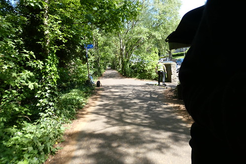
"they seemed to be traveling by bike"
Someone was measuring about with the future bench sites on the Roseburn one day last week and appeared to have cycled there wearing a hi-viz tabard and hard hat.
Hopefully a double-yellow to stop parking from blocking it too?
Unless I'm mistaken, double yellows require a TRO to be advertised...
In my efforts to get some idea of what is actually being done where, I have now been offered a full set of drawings on a hard drive - apparently there are a great number!
I don't want to have to sift through them!
I was asking for a simple list. I shall keep trying.
Meanwhile, would anybody be interested in the drawings if I did get them?
The dogleg/puddles/Roubaix-surface at Boswall Tce on the Ferry Road section will be getting resurfaced, CEC have confirmed. Somehow the contractors have finished adjacent sections and need to return to this one.
The dogleg/puddles/Roubaix-surface at Boswall Tce on the Ferry Road section will be getting resurfaced
OMG, and I was just thinking this morning that it wasn't looking hopeful. It's the one remaining bit of the path which really needs done. Can it be so? CAN IT? Please don't let me be dreaming this.
"would anybody be interested in the drawings if I did get them?"
I do like a good scale engineering drawing.
Has the work stopped? As I was passing the compound at Craigleith this morning, I was sure I spotted the Crummock branding on the vehicles therein - and I know that they've gone under in the last week.
Really annoyed by the unfilled section at the bottom of the Chancelot path, which is about 1 to 2 inches lower than the surrounding path, and where all warning signs which previously indicated 'Ramp' have gone. Mind you, all other indications of ongoing work there have vanished too - which was what made me think that the work has unexpectedly ceased.
(On the other hand, that kind of thinking at 6am may have caused my active imagination to see the word 'Crummock' on the vans later when it wasn't actually there!)
On the other hand, that kind of thinking at 6am may have caused my active imagination to see the word 'Crummock' on the vans later when it wasn't actually there!
I saw one yesterday that had had the "Crummock" peeled off.
I ran through the crossroads at the bottom of Chancelot at lunchtime - final fill going in, should be done tonight by the look of it. Hopefully the same for the Warriston Road hole in the wall.
Yep - spoke too soon. Filled in at the end of the Chancelot Path by the time I rode home this afternoon, and new work started at the Boswall crater-field since this morning too. 'A' Plant branding on the parked-up dumper truck there.
Warriston Road turn-off section still needs another layer, but there are still two vehicles parked on the bridge over the crematorium so they might be going back tomorrow.
"There is paint marking a desire line towards the Warriston Crescent exit."
This started today along with something on the little section between Warriston and Goldenacre.
I notice that the junction between WoL path and Chancelot path is now nicely resurfaced, they've widened it at the corners and improved the sightlines. Much better.
Access to the Roseburn Path from Wester Coates Avenue is blocked off with fencing. You can get onto the path from the bottom of Wester Coates Terrace but its a bit of a leg checker.
Just a reminder of the thread title -
“Resurfacing of NEPN”
Clearly this hasn’t happened - and was never intended to.
I’m aware that there have been some major bits of work around Roseburn, but I don’t suppose we’ll ever know if the £900k has been ‘well spent’.
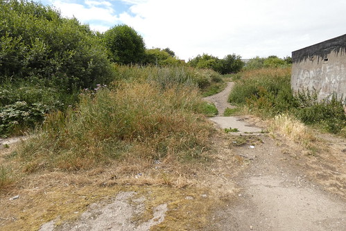
On Wednesday I rode the Canonmills to Drylaw section and found bits of work best described as tinkering, some seemingly abandoned sites for seats and a serious bit of unaddressed desire.
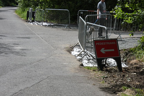
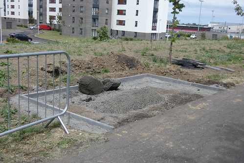
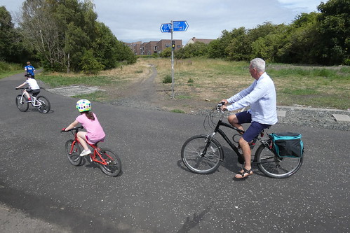
The last picture seems to show two bench bases, but the point is it also shows a clearly well used desire line to a housing area that is presumably not on any CEC list for improving and expanding the paved path network.
This photo shows the Telford Drive end.
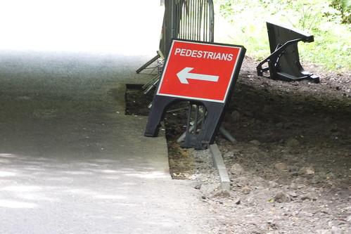
Quite a few of the edges under the bridges are unfinished as well.
Yes, wasn’t clear what was happening here -
Prob cos of Builders holidays for last 2 weeks.
EDINBURGH:
SUMMER: Friday 29th June – Friday 13th July
Yes but no.
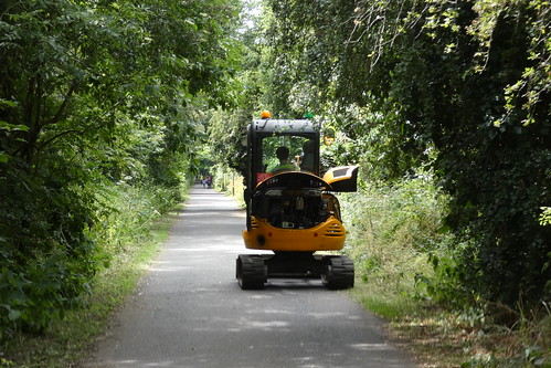
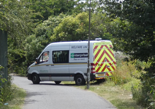
Am really quite cross. Child has holiday camp in Bonnington (really only made possible by the fact of easy access from the NEPN, otherwise Shandon-Bonnington-Southside isn't a feasible commute timewise). The path is closed at Ainslie Park, with a single sign dumping you into the lesiure centre car park. No diversion map, no signed diversion, not even a wee note telling you at which point the path is reopened. Commuting along Ferry Road isn't really something for a 9yo. After several wrong turns arrived 20 minutes late instead of 10 minutes early, and really quite grumpy after a fall on the gravel on a minor road somewhere in Trinity. Not really acceptable. Have sent an irate tweet to @edinhelp.
@piosad Presumably the diversion SHOULD be to cross the bridge then turn left into the new ("City Park"?) estate opposite Morrisons, take a left, then a right, then find the new (but heavily-chicaned) access back to the path after the second or third block?
@wingpig the one off East Pilton Farm Wynd? (I only know this part of town by map.) We tried that and it was closed (just a fence, not even a sign). Likewise Granton Road. At that point I gave up checking every possible access and went on the back roads. We finally got back on at Clark Road, though it wasn't closed there, so presumably the other end of the closure is further west. Will find out when going back in the evening but really.
Ah no, that's not what you meant. I didn't even know about that one, but I presume it's also closed since it's just at the same bit of the path as the one we tried.
Has anyone been along the NEPN through Drylaw since Monday morning to verify if the work to fix the ponding is underway?
NEPN TELFORD PATH City of Edinburgh Council

Drainage and surfacing improvements.

Path closed between Easter Drylaw Drive and Ferry Road Path.

23-Jul-2018 09:00

03-Aug-2018 17:00
You must log in to post.

 Cycling in Edinburgh Flickr group
Video embedded using Easy Video Embed plugin