CityCyclingEdinburgh Forum » Infrastructure

Port Hamilton development

(20 posts)

No tags yet.


  1. neddie
    Member

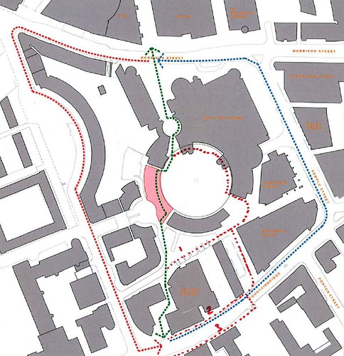
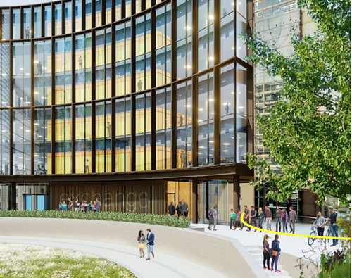
    Montagu Evans are a proposing a development at Port Hamilton / Scottish Widows building. It's on the cycle-route cut-through between Morrison St and Fountainbridge.

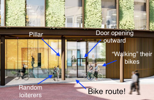
    It’s not big enough to require a PAN but it does affect the pedestrian and cycle route where it goes up a gentle ramp from the street called Port Hamilton, to the pend under Scottish Widows; the path is currently bounded by a hedge.

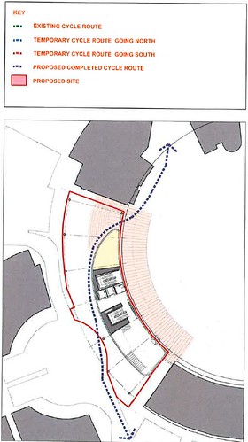
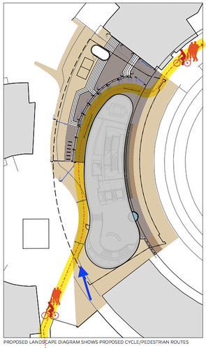
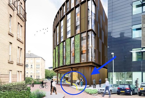
    The plan is to build on this ramp, to fill a gap in and to complete the circle of buildings. But the building will overhang the ramp (or maybe be on stilts), so eventually on completion the cycle route will be maintained.

    The problem is that the ramp will be closed during the construction phase, for about a year.

    port hamilton 1 by Ed, on Flickr

    port hamilton 2 by Ed, on Flickr

    Posted 6 years ago #
  2. Murun Buchstansangur
    Member

    Widows should be forced to allow the cycle route to be directed around the other side of the internal circle (ie the red dotted line above) for the duration of construction as a condition of planning. Presumably they are amongst those looking to profit from this? (unless they have already cashed in on the land?)

    Posted 6 years ago #
  3. Stickman
    Member

    They sold the building a few years ago.

    Posted 6 years ago #
  4. gembo
    Member

    Shame that is a nice cut through, though I have never used it? Gardeners Crescent to the west is ok but semple st to the the east is poor.

    When it gets to Morrison st you could then continue cycling through similar office developments to Lothian road or even Rutland sq?

    Good that such access exists ev n if not much used.

    What was in this area before all the developments? Was the Caledonian station an access to lower level trains as Rutland square seems to predated the railways?

    Did the WAR bulldoze a residential areas, like the M8 removed Cowcaddens as a place where people lived?

    There must have been a hill of some sort? As quite a bit of lower level carparks and tunnels etc?

    Posted 6 years ago #
  5. PS
    Member

    Good that such access exists ev n if not much used.

    It is pretty heavily used. The stretch along Exchange Crescent and across the bridge to Rutland Square sees a lot of cycle traffic during the day. It's just a shame it was obviously designed solely for pedestrians, with folk on bikes being accommodated as an after thought.

    Posted 6 years ago #
  6. I were right about that saddle
    Member

    @gembo

    All this was once railways. Lines and lines and lines and lines.

    Posted 6 years ago #
  7. gembo
    Member

    @iwarts, thankee, the Haymarket to Wav tunnels right under Caledonian.

    @ps busy with cyclists? Up that mad ramp with all the loose paving?

    Posted 6 years ago #
  8. I were right about that saddle
    Member

    Standard Life House I make it. Undermined.

    Posted 6 years ago #
  9. PS
    Member

    Up that mad ramp with all the loose paving?

    That bit by the horse statue outside Anderson Strathern? Repaired last week.

    Busy to the extent that cyclists are sighted frequently. It's no cycling superhighway, but that's because it's no cycling superhighway. A wider bridge and a more sensible approach than the twisty-turny ramps would have made it more practical.

    Posted 6 years ago #
  10. neddie
    Member

    A wider bridge

    I think the bridge is reasonably wide at its base, but the sides angle in toward the path and there is a stainless steel railing at cyclists' eye-level height that narrows the practical width even further.

    Stupid architects' fancy stylised design versus actual practical use.

    Posted 6 years ago #
  11. neddie
    Member

  12. neddie
    Member

    The drawing below shows the proposed bike route. Note I've added the big blue arrow to correspond to the entrance to the bike route in the following picture

    bike route marked by Ed, on Flickr

    Here is the entrance marked with the same blue arrow. The yellow line shows the bike route you are supposed to follow. What could possibly go wrong?

    entrance marked by Ed, on Flickr

    Posted 5 years ago #
  13. neddie
    Member

    The other end (the "exit") isn't much better either. Again, the yellow line shows the route you are supposed to follow - through that line of gentlemen and a pillar!

    exit marked by Ed, on Flickr

    Posted 5 years ago #
  14. neddie
    Member

    And the "piece de la resistance":

    narrow marked by Ed, on Flickr

    Posted 5 years ago #
  15. gembo
    Member

    @neddie, excellent diagrams. Reminiscent of great cover of High Times where one arrow was pointed at Bob Marley and was entitled Bob and the other arrow was points at the massive lump of ganja in front of Bob and was entitled Herb

    Posted 5 years ago #
  16. neddie
    Member

  17. neddie
    Member

    Comments & objections to be submitted by 17th Oct 2018

    Planning ref: 18/07354/FUL

    Posted 5 years ago #
  18. Tulyar
    Member

    The cycle parking .pdf is not available - has it been withdrawn?

    What a crap design.

    Correct that the NBR tunnels run practicallu parallel with West Approach Road, although I also suspect that Caley (Princes Street Station) used poor ground conditions as a good reason to provide lower levels for storage & freight at Princes Street Station, whilst providing substantial foundations for the buildings above.

    One detail which might deliver an enhanced capacity for Waverley, might be to restore the Caley alignment through from Slateford, and use the under-used West Approach road footprint to take extra tracks which then drop to go under Lothian Road/Kings Stables Road to run alongside the existing tracks around the base of Castle Rock and a new bore through the Mound into the 'Sub' (Platforms 8-9 plus the through platforms 7, 10,11)

    The geology is not solid rock, although its wetness and weakness will require some care to work with

    Posted 5 years ago #
  19. Frenchy
    Member

    The cycle parking .pdf is not available - has it been withdrawn?

    Working for me, if I go via the planning portal:

    https://citydev-portal.edinburgh.gov.uk/idoxpa-web/applicationDetails.do?activeTab=dates&keyVal=PEY7EQEWKSS00

    For reasons that probably make sense to someone, direct linking to the documents to themselves only works temporarily.

    Posted 5 years ago #
  20. neddie
    Member

    Reminder:

    Comments & objections to be submitted by 17th Oct 2018

    Posted 5 years ago #

RSS feed for this topic

Reply

You must log in to post.


Video embedded using Easy Video Embed plugin