CityCyclingEdinburgh Forum » Infrastructure

Canal-Meadows (STILL NOT finally!)

(309 posts)

No tags yet.


  1. chdot
    Admin

    "there will have to be bollards at the end of tarvit to allow the theatre lorries to get out. but, my impression was that council officers were fairly comfortable about closing the road."

    They were less comfortable a few years ago.

    After it had been shut for a few weeks (months?) for some sort of road works, I asked CEC if they had done a survey to see where the traffic went instead.

    "No".

    Posted 9 years ago #
  2. neddie
    Member

    Buses queuing at the bus stop northbound on Home St present a problem when exiting Lochrin Place.

    Frequently I have to wait to get out of Lochrin Pl, because a bus is blocking the exit while it waits to get to the stop (1 bus already at stop)

    Posted 9 years ago #
  3. SRD
    Moderator

    @eddie_h this was definitely discussed and a whole range of options considered. I'm pretty sure that in the proposal changes are being made to buses/loading etc to prevent this happening.

    Posted 9 years ago #
  4. neddie
    Member

    The canal (and the cobbles around the towpath) may well be an historic and listed monument.

    But I just don't buy all this stuff about: "We couldn't possibly put a smooth surface down instead of cobbles because it is an historic monument."

    They already managed to build this monstrosity, on top of an 'historic monument', complete with a smooth section of path by the frontages:

    http://i.imgur.com/jQLR3eF.jpg

    And there is a smooth (small flat flagstoned) section of path from Cargo toward the student flats here:

    http://i.imgur.com/2Xjvvyc.jpg

    which misleadingly leads you to the top of an invisible (especially at night) set of steps, ready for you to go tumbling down, here:

    http://i.imgur.com/70W3oNH.jpg

    So why can they not just create a path like the one in the 2nd image from Lower Gilmore Place to the student flats???

    Posted 9 years ago #
  5. Rosie
    Member

    I work in Fountainbridge, in Quay 2, the big glass box by Tesco's. This is very cheering.

    I know what you mean by cobbles. I come in the morning along the canal which I pick up at Harrison Park, and then over those tooth-looseners. Evening I turn left along Fountainbridge and pick up the canal by turning left on to Gilmore Park.

    If I'm going to the Grange/Newington area I won't even attempt the Gilmore Place/Tarvit Street junction. It's a game of chicken. So I go (illegally) along that short one-way stretch of Gilmore Park and then cross to go up Leamington Road to pick up the Bruntsfield cycle path. It's a lot longer and hillier but much pleasanter. But this sounds good and may change my route to the south.

    I've filled in your survey monkey.

    Posted 9 years ago #
  6. Nelly
    Member

    @SRD - having looked at the route since yesterday I need to revise my thoughts - those cobbles are also horrific on the south side - I had stupidly thought that they would at least have made a navigable path - I wouldnt touch it with son because of that, to be honest, too unpleasant (worse than the aqueduct).

    Posted 9 years ago #
  7. steveo
    Member

    Perhaps one for Morningsider, but I wonder if the cobbles could be relaid in a more useable manner. TBH I can live with them, used to join at Cargo 3 from 5 days on either 700x25 fixed or 700x23 racer. I had to take my time compared to folk on a wide tyred bike but its only 20-30m

    Posted 9 years ago #
  8. Morningsider
    Member

    The Union Canal and its tow path is a scheduled monument. The new build in the photos above is just outside the monument boundary. I don't see why the cobbles couldn't be relaid. There is no reason why Scottish Canals couldn't apply for scheduled monument consent to run a section of smooth path over some of the cobbled area. It should be granted, given that an area of cobbles could be maintained and it would greatly improve access.

    Full details: http://data.historic-scotland.gov.uk/pls/htmldb/ESCHEDULE.P_ESCHEDULE_DOWNLOADFILE?p_file=11097

    Interestingly (okay, maybe stretching it a bit) the scheduling pre-dates the millennium link project and still refers to the old culverted section at Wester Hailes.

    Posted 9 years ago #
  9. kaputnik
    Moderator

    If the cobbles (setts) are protected, surely there's no reason they can't be lifted and re-laid in a manner which doesn't shake bicycles and cyclists to pieces.

    Posted 9 years ago #
  10. steveo
    Member

    old culverted section at Wester Hailes.

    I did always wonder where it went prior to the millennium work.

    Posted 9 years ago #
  11. neddie
    Member

    @Morningsider.

    Looking at the HS map of the canal scheduled monument, it does appear to me that the building (and smooth path) shown in my first photo (http://i.imgur.com/jQLR3eF.jpg) encroaches on the boundaries of the monument.

    The map is not detailed enough to show how far the monument boundary extends out to the Fountain apartments near the corner of Lower Gilmore Pl. i.e. there could be a 'gap' between the 'historic towpath' and the new builds...(?)

    Posted 9 years ago #
  12. kaputnik
    Moderator

    I can't see the photos, but looking at the boundaries of the Scheduled Monument on PastMap, it would seem that the small, detached triangular-plan building between Cargo and the Fountain Park apartments does indeed encroach slightly on the SAM.

    Posted 9 years ago #
  13. I were right about that saddle
    Member

    @Morningsider

    The culverted section....I cycled out the canal to Wester Hailes as a student. It was the only time I'd done that prior to my current daily commute.

    Hazy memory of the canal 'ending' somehow, but it's not quite clear. Was the canal covered over?

    EDIT

    http://www.jamescanalpages.org.uk/unioncanal2.php

    Posted 9 years ago #
  14. Morningsider
    Member

    The new build may encroach on the scheduled monument site. There are two possibilities here:

    1. The developers obtained scheduled monument consent, which allowed them to do so.
    2. The developers didn't obtain consent and no-one cares.

    Posted 9 years ago #
  15. gembo
    Member

    @iwrats in late 1990s big push for Internet cafe to be built in wester hailes. Was eventually built near the then hailes land primary an establishment I had the huge honour to work in for many years. About a year after it was built it was knocked down to make way for the re-established canal. Hailes land then renamed as Canal View.

    Posted 9 years ago #
  16. fimm
    Member

    I've done the survey.

    Posted 9 years ago #
  17. wingpig
    Member

    Surveyedmonkey.

    How do you get into Tarvit Street from Bruntsfield Place/Home St northbound? Carry on to the toucan at Lochrin, or will the lights at the King's junction be changed?

    How will cyclists use the two-way segregated cycleway between Tarvit St and North Meadow Walk when a car is sitting right on top of it as it attempts to exit Lonsdale Terrace? How will drivers be persuaded to not encroach on the two-way segregated cycleway?

    Apart from that, just the usual bits about making sure people can get onto the ends of the toucans via ramps, and frequently inspecting progress to make damn sure that the ramps/dropped kerbs are installed during the initial installation, and are installed to a suitable standard to allow them to be used by people with heavy vehicles, reduced strength, large cargoes, wide turning circles etc.

    Posted 9 years ago #
  18. SRD
    Moderator

  19. daisydaisy
    Member

    This sounds very promising. There is also a drop-in session today at Barclays Church (Pillar Hall) on Thursday 2 October 2014 between 4pm and 8pm where you can see large-scale plans and discuss them with the Council's project team.

    Posted 9 years ago #
  20. SRD
    Moderator

    I'd not realised the drop-in session was TODAY! Hope some folk here can make it along.

    Posted 9 years ago #
  21. neddie
    Member

    My survey comments:

    In general the scheme should be designed so that it is advantageous to cyclists to use it. i.e. there is no benefit (time, safety) from taking the road, otherwise cyclists will end up using the road anyway.

    It is important that pedestrians & cyclists are given genuine priority on both new toucans, particularly at Lochrin Pl. At present, the Lochin Pl pedestrian crossing is a slave to the traffic lights at the King's Theatre (i.e. the button does nothing) which means that pedestrians have to wait a long time to cross, or they simply cross anyway on the red man. The toucans should trigger immediately the button is pressed (better still, set the toucan to default as 'green man', motorists have to get out and push a button - that would be genuine priority to peds & cycles, as per the council's own hierarchy!)

    Cyclists on the segregated section along Brougham Pl should have priority over vehicles entering/exiting Lonsdale Tce (as they would do on the road).

    The cobbles on the towpath between the new development at the west of Lochrin Pl and Lower Gilmore Pl need to be relaid as smooth flat top setts. The present surface is unsuitable for children or any bicycle other than a mountain bike. Although the towpath is a scheduled monument, this has not stopped other 'smooth' paths appearing on it next to the new developments on the Quay, so there should be no reason that the towpath cannot be smoothed in this section.

    There is no need for such a long right turn filter lane on Home St (for turning into Gilmore Pl). The pavements on Home St between Lochrin Pl & Lochrin Tce should be widened instead to make shopping more convivial.

    Posted 9 years ago #
  22. Arellcat
    Moderator

    Hope some folk here can make it along.

    I only saw daisydaisy's comment because I was reading CCE while having my breakfast this morning, and I'd already packed and dressed for a torpedo commute. I re-packed everything and took the folding bike, so I'll be Barclay Churching after work today.

    Posted 9 years ago #
  23. Min
    Member

    Home Street is a bit closed at the moment due to this

    Posted 9 years ago #
  24. Cyclingmollie
    Member

    That's a good route. It's how we get to the orthodontist in Gilmore Place from East Lothian, getting the train to Haymarket i/o Waverley. It probably makes more sense than Waverley for a lot of central Edinburgh destinations - the Meadows, Tollcross, Morningside, Fountainbridge.

    Posted 9 years ago #
  25. chdot
    Admin

    Unfortunately I arrived at the event having had an unnecessary/too close pass by a Lothian bus. (I will be complaining.)

    So perhaps I wasn't ready for another disappointment.

    I was hoping - actually expecting - to see detailed plans that I could say 'nothing can ever be perfect but that's really good'. Maybe have the odd quibble about fine detail and (almost certainly) 'well it would be even better if CEC was brave enough to remove a few more parking places'.

    I found plans that lacked vital details and staff who didn't adequately know what they were in charge of presenting.

    There were a reasonable number of people there - even some CCEers...

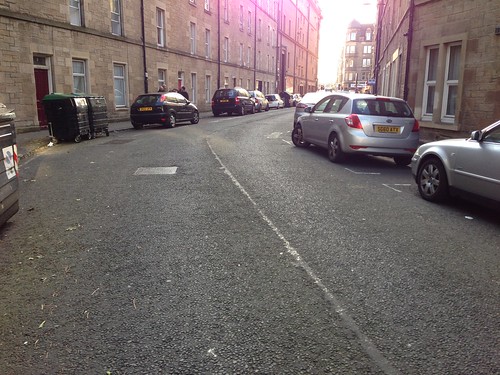
    Most concerns seemed to be about Tarvit Street (a key part of the scheme). There was/is great confusion about whether it is proposed to be two way for cars/lorries (as well as bikes). Staff assumed not - even though the "HAVE YOUR SAY" leaflet says "2-way cycling and vehicle movements would be permitted on Tarvit Street which is currently one-way.

    One plan on display has a heading saying contra-flow cycle lane, but only cycle symbols (in both directions are shown). There is no room for two way general traffic and even one cycle lane unless parking is removed (the plan is to remove some spaces on the bend only).

    The plan is to shut Tarvit Street at Home Street - which is good, but there is no detail of the junction with the proposed two way lane on the east side of Home Street). That ought to be a minor issue, but the fact that it hasn't been done is disappointing.

    More worrying (to me) are two key concerns -

    One has already been mentioned this thread - the provision for bikes wanting to go along Gilmore Place.

    Another, which I don't think has been mentioned, is the necessity for vehicles to turn round in the closed end of Tarvit Street. The plan is for an "All Day Loading Bay" on the south side with "Widened Footway" on the north.

    So quite a lot of three point turning on a flagship two way cycle route(?)

    No doubt others will add reports.

    Posted 9 years ago #
  26. SRD
    Moderator

    I was hoping for more detail too...

    Posted 9 years ago #
  27. algo
    Member

    I was really pleased to be able to go to this and I thought the representatives from the council were very receptive to suggestions - although insistent this was just an option and the details were yet to be figured out. I was confused by the "contra-flow cycle lane" marked for Tarvit street - given there wasn't one marked and they had not indicated any traffic one ways. I was pleased chdot was there to add weight and also realise a problem with the design (as documented by chdot better above)...

    a real contraflow in my opinion should be segregated and there's no space there for it if they want to keep the parking and appease the residents. The bollards at the end with the King's theatre are removable to allow access for the big trucks that bring the shows so I'm not sure there's a need for a two way street at the Brougham place end.

    I think the use of the word "option" on the designs is bit of a misleading misnomer - Option 0 is how it currently is, and Option 1 is what is being proposed...

    Nice to bump into SRD, mini-SRD-mk1 and wingpig...

    Posted 9 years ago #
  28. chdot
    Admin

    "chdot was there to add weight"

    Not sure about that.

    Wasn't in the mood for dealing with so many unknown unknowns.

    I was not impressed with "Option 1" - there wasn't an Option 2.

    There was "Option 0" which must have seemed like a good idea to someone.

    But the status quo isn't an "option"

    IS IT???

    Posted 9 years ago #
  29. chdot
    Admin

    Parking spaces to be removed on bend -

    No room for two way (motor) traffic and two bike lanes.

    Just about room for 'normal' one-way street plus a segregated contra-flow on inside of parked cars.

    Council was arguing that when TS is shut to through motor traffic, there won't be much. Probably true but not a good for making it a two way street.

    Posted 9 years ago #
  30. SRD
    Moderator

    In the first stage consultation there were 3 options for each segment. I honestly do think this is the best of them.

    One option did have proper segregated contra flow cycle lane but not tarvit street closed. I originally preferred that option, but think that tarvit street closed is a better solution for more people.

    I wanted more detail on how cyclists will get from tarvit to GP, on how responsive toucans will be, and so forth. I was not that reassured on the toucan front.

    Posted 9 years ago #

RSS feed for this topic

Reply »

You must log in to post.


Video embedded using Easy Video Embed plugin