CityCyclingEdinburgh Forum » Infrastructure

A8 route - Consulation

(161 posts)
  • Started 8 years ago by acsimpson
  • Latest reply from HankChief

No tags yet.


  1. acsimpson
    Member

    I've just found this on the Council website: http://www.edinburgh.gov.uk/info/20087/cycling_and_walking/1391/a8_route

    I don't recall seeing it on here but note "There will be a drop-in session at Corstorphine Library on Wednesday 9 December 2015 (4-7pm) where there will be plans and a member of staff to answer questions.

    Consultation will be open until the 18 December 2015. Comments can be sent to cycling@edinburgh.gov.uk."

    Improving the route from Newbridge through to Gyle park. I've had a glance and notice a couple of things

    1) The route will be built in two phases, the first are minor works and the second is larger bits. My thought was that the larger bits would include a path on the north of the A8 between airport and RBS but this isn't the case so the final route crosses the road at both these points.

    2) They will be removing sheffield stands at South Gyle Station stating that they are unused. I don't know if there is other parking at the station which is a better provision but hope this has been taken into account. I will find out more as this will probably feature heavily in my commute while the FRB is shut.

    3) The crossing of the A8 at Dechmont Road will still be staggered in the wrong direction which will increase the potential for cyclists waiting to cross to block the pavement.

    4) When I feed back I will also be making the comment that if the Start of Maybury road can be single lane northbound then there is no reason it can't be single lane as far as the roundabout. The second land is predominately used by otherwise law abiding speeders.

    5) Hankchief has grumbled about the dropped kerbs at the tram depot in the past but there is no mention of improvements there.

    I only use the sections of the route between Maybury and town so others will be far better placed than me to comment on this.

    Posted 8 years ago #
  2. chdot
    Admin

    Presume this means the racks in the park(?)

    Never seen them used - for fairly obvious reasons.

    There used to be lockers in the car park, but they were hardly used and then vandalised and eventually removed.

    Bike parking at 'remote' stations needs to be overlooked, well lit and on very obvious CCTV.

    Removal for not being used is one thing, not providing useable facilities is another...

    Posted 8 years ago #
  3. kaputnik
    Moderator

    They will be removing sheffield stands at South Gyle Station stating that they are unused.

    If they mean these; https://goo.gl/maps/LqWscfoaExK2 then yes they are Sheffield Stands but they are installed not as bike racks but as bollards to keep the entrance point to the platform clear from parking! Who would seriously lock their bike up there!?

    Posted 8 years ago #
  4. Nelly
    Member

    Bike parking at Edinburgh Park station is also poor - and one rack is entirely taken by a BSO which is really just an advert for the Gyle barbershop.

    Posted 8 years ago #
  5. acsimpson
    Member

    The plans seem to suggest they are at the entrance to the station from the park.

    Posted 8 years ago #
  6. HankChief
    Member

    Hmmm... A bit miffed that I didn't get notification of the consultation starting seeing as I have been emailing on a regular basis for when it would come out...

    It's here now and on the whole I think it is a reasonable job across a number of locations with limited funds and taking on board previous feedback.

    Certainly the bits where I think that one day my luck will run out are being addressed - it is a bit 'tactile-tastic' though and there are several bits where the detail isn't clear and a few bits that I don't understand...

    As Stickman says the juicy stuff will come in phase 2 in 2017 and nearly all of it being done without any significant impact on motor traffic.

    I hope people don't mind if I do another mammoth post taking it bit by bit starting in the West - feel free to correct me if you think I'm wrong.

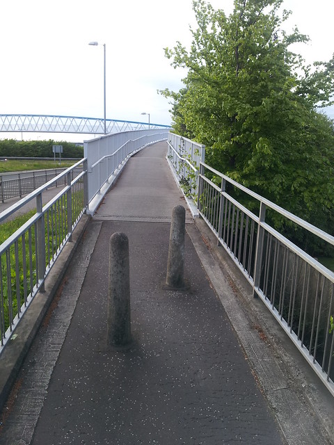
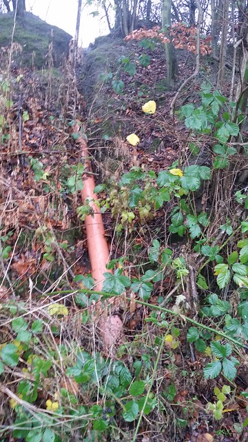
    1. Newbridge bridge will have it's bollards moved to having a 1.5m gap between fence & bollard but only 1.5m between the two bollards and not the standard 3m. I'll be asking why.

    Newbridge bridge West side by HankChief, on Flickr
    Newbridge bridge Eastside by HankChief, on Flickr
    They are also smoothing the radii of the corners on the path as it approaches bridge, which is good.

    The designs have 'no cycling' painted into the pavement for heading NW under the footbridge and onto the old railway line to Kirkliston. Don't understand why that is?

    2. Lochend Road Junction. A slight tightening of the entrance radius (and talk of a potential refuge). Moving the bus shelter off the path will make a big improvement.
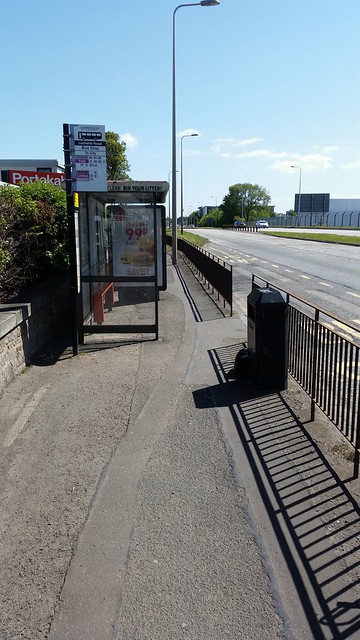
Lochend Rd Bus stop by HankChief, on Flickr

    It looks like some resurfacing & widening for the next section East but not doesn't go into details

    3. Ratho Station Overbridge steps will get a flat channel for pushing bikes over. Good idea.

    4. Ratho Station houses - talks of Parking Improvement, Carriageway realignment and path widening in phase 2 but no details. Need to see what that will be as overgrown hedges and bin day currently make it a real challenge.

    Ratho Station Path by HankChief, on Flickr

    5. Ratho Station to Halyards Road - changing access road priorities to path users is welcome. Halyards Road junction will be improved but I can't see any details.

    6. By Royal Highland Showground - talks or religning paths to better fit through poles, but nothing on smoothing out the bumps or moving the bus stop.

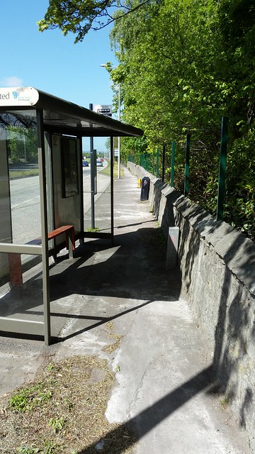
    Bus stop by RHS by HankChief, on Flickr

    7. Ingliston Road Junction. Putting in dropped kerbs which will mean you can ride straight across which is good, but the jnct remains mainly unchanged.

    8. Aiport Dumbells. Scraping back the paths on the approaches is welcome as is the making the path underneath the A8 to be 3m wide - (horrid sightlines & narrow path before). Some indication of improving the radii of turns as you come down the ramp from Ingliston Rd and want to head under the A8.

    9. Gogarstone Road Entrance. Path widening and refuge put in so you can cycle in a straight line across it. I'm slightly concerned that the sightline won't be good to see vehicles approaching from Gogarstone Road, but the view of vehs exiting the A8 will be much improved.

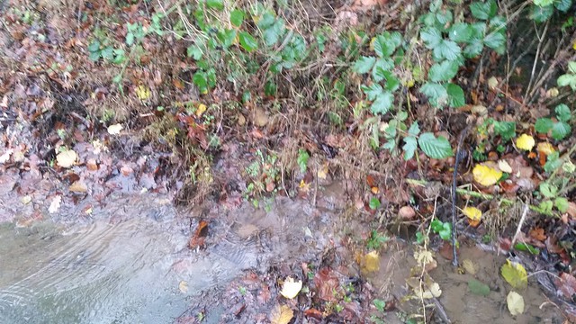
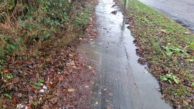
    10. RBS to Tram depot. The entrances to the Cabinet works and Gogar Castle will be changed to give path users priority (& hopefully remove the puddles from them). I'm very keen to understand how the Castle Gogar one will be done.

    11. Maybury Road. Keeping Northbound 1 lane until past North Gyle Terrace, with a right turn lane and refuge is great idea - as Stickman says why can't it be continued to Bughtlin RAB - the 2 lanes are only useful for storing the queuing traffic for Barnton/Mayury junctions.

    Sorting out the dropped kerbs will be very welcomed. It will be interesting to see how cyclists use it. Wait for the toucan, use right turn lane or refuge...

    I'm not totally convinced about the bike gate as you head west out of North Gyle Terrace (bike lane on left of bollard making it 1 road lane with priority to Eastbound traffic). NGT is used at rush hours as a rat run to avoid the queues on Maybury / Drumbrae and so you often get queues of people trying to turn left out of it and making use of the yellow box on Maybury road to feed into both lanes.

    I can't think of a situation where the bike lane will help with progress that couldn't be done without it. One I'll raise with the designer on Wednesday to understand it.

    12. Dechmont Road Toucan. Some minor improvements at the toucan (which will still be 2 stage) and better signage - which I always thought was lacking.

    13. Craigmount Steps make an appearance on the plans but only as 'potential' and in phase 2, which is a disappointment as I've been banging on about them for a couple of years already.

    13. South Gyle Park / South Gyle Gardens. Resurfacing, removing tight corners and signage improvements are all welcome.

    14. A8 South Side: Marriot - Gogar Path Upgrade. No details but this would be very welcome especially with the Edinburgh Gateway station opening up.

    Posted 8 years ago #
  7. chdot
    Admin

    "I hope people don't mind if I do another mammoth post taking it bit by bit"

    Definitely NOT!

    Very good that people take the trouble to look/read/write AND post here for others to read (the don't have to!) so that they know what's happening - and informing their own comments (or not).

    Posted 8 years ago #
  8. paddyirish
    Member

    Great work all, Hankchief in particular. Referring to the points on Hankchief's email.

    2. This is unpleasant heading Eastbound with fast vehicles turning left from behind you, often not indicating. Not quite as bad as 7 below (speed 40 vs 70), but still not great.

    4. If there is ever a site visit with powers that be, please can it be made on a Thursday? It is bin day and bins add considerably to the challenge.

    Id really like to investigate whether a cycle path can be routed behind the houses. I think residents and cyclists alike would welcome it. It will of course be more expensive, but it would be a permanent solution.

    6. This is a particularly rough bit of path and it feels like any amendments to the existing on are sticking plaster. Is there any way a path could be made inside the retaining wall?

    Also, heading westbound in winter, this part is particularly vulnerable to bright headlights, the glare of which can be blinding. Vanes a la A90 would be welcome, but only if they are effective. Those on the A90 are far too low to be effective (a major disappointment)

    7. This is unpleasant heading Eastbound with fast vehicles turning left behind you, often not indicating. Also there seems to be a massive amount of glass here all the time. Some sort of acknowledgeent of that and a regular effort to clear it up would be welcome.

    9. This is downright scary. Sightlines on traffic coming along Gogarstone Rd (too fast) when travelling eastbound are non existent. I feel like it is a lottery every time I head out to cross the road. aybe some sort of speed bumps/traffic calming to stop drivers revving up to the last minute would be welcome.

    Posted 8 years ago #
  9. cb
    Member

    Looks generally quite promising, although they're starting from a pretty low base line on this route.

    I wonder how they will manage path closures during the work? West of the airport there is the option to use either side of the road.
    I wonder if they'll put in a long detour via the back roads to Ratho?

    Posted 8 years ago #
  10. HankChief
    Member

    One thought I had this morning is that it does nothing for the other routes round/under/across the Gogar Roundabout.

    I'm not sure what the %ages are but I'd guess that fewer than half of bikes go all the way round the Northside.

    It would be too big for this project but still worth commenting on as the Development Plan for the 1,500 houses on GSR talks about re - engineering Gogar Roundabout to increase capacity, so maybe some safer crossing could be installed as part of that.

    Posted 8 years ago #
  11. acsimpson
    Member

    Thanks Hankchief, I hoped you (or others) would have a better overview of the full route (And I'll forgive you calling me Stickman).

    Good spot on the Craigmount steps, I'd missed that. Definitely something worth pushing for.

    I think they are hoping the underpass removed the need for the links to the north of Gogar RAB, however you are right that the houses would change all that. I suppose putting that in the feedback might be worth it, not in the expectation that anything happens but more so that it isn't forgotten about when they come to plan the housing.

    Regarding the parking removal at South Gyle, this is what it currently looks like, I suspect they are correct that it is never used. I assume it predates the CCTV and certainly isn't covered by any that I could see. Better to lock your bike to the fence at the main station entrance and have it watched. I'll be feeding back that they should add some proper monitored and covered parking, however think they may feel that this is Abelio's job to provide.

    Posted 8 years ago #
  12. HankChief
    Member

    Sorry StickmanACSimpson.

    Reminder that the drop in session is tomorrow (Wed) afternoon 4-7pm Corstorphine Library.

    I won't be there as (hats off to CEC for this) they are coming to a certain large Financial Services company on the route to gather feedback/views etc. of the regular cyclists beforehand.

    Very pleased at this engagement.

    AC - any word on East Craigs Dropped Kerbs?

    Posted 8 years ago #
  13. acsimpson
    Member

    Hankchief, I hope to make the session this evening so any feedback from your "private" consultation would be good, especially if you feel certain points need repeated.

    Did you get my email regarding the dropped kerbs? Various positive noises and agreements around certain issues but no definite projects yet. I wouldn't expect to see them for a while though.

    Posted 8 years ago #
  14. HankChief
    Member

    AC - the private consultation was very good. The chap from CEC had a constant stream of visitors for 2 hours and greenroofer & I were also speaking to the overflow...

    Hard to estimate but I'd say about 50 people took time to engage - it was great that he took the time to come out to us.

    He left with lots of post-its and several people brought long lists of comments which he also took away (including this thread)

    I would say it is still worth following up with emails though to make sure nothing is lost.

    Biggest concerns were the junctions at Lochend Rd & Gogarstone Rd and lots of tales of incidents at them.

    Don't think the current plan does enough to slow down traffic joining/exiting the A8 at these points and the sight lines are bad for both drivers and cyclists (& we know who always end up worse)

    I made the suggestion that Gogarstone Rd needs a chicane or speed bump just South of the junction, to slow the traffic down.

    Lochend Rd could do with the radii tightening as well as a refuge.

    The other one to push for is to make one or both of the Maybury Rd footways into shared use. A lot of support for it here but I expect it will need more to get it changed.

    (Have found your email on East Craigs Dropped Kerbs. Will read & revert)

    Posted 8 years ago #
  15. chdot
    Admin

    Now doubt this is being factored in...

    "

    Developers have lodged outline plans for an International Business Gateway on 90 acres of fields and scrubland next to Edinburgh Airport, stretching from the RBS headquarters at Gogarburn to the Royal Highland Showground at Ingliston.

    "

    http://www.edinburghnews.scotsman.com/news/edinburgh-airport-business-park-plans-lodged-1-3972165

    Posted 8 years ago #
  16. acsimpson
    Member

    The guy running the consultation was aware of it. Although the current path is on the other side of the A8 for most of this stretch he hopes the planning process will ensure that a path is built on the north side too.

    Best feed that back to this planning application too.

    Posted 8 years ago #
  17. Blueth
    Member

    Well he was aware after one of the earlier arrivals had pointed it out.

    Poor communication within the Cooncil perhaps.

    Apart from that I think they've got the right man on the job.

    Posted 8 years ago #
  18. HankChief
    Member

    As I say over on the other thread the IBG planning application does talk about a cyclepath on the North side of A8 to complete 'missing link'

    Posted 8 years ago #
  19. HankChief
    Member

    Spent this afternoon doing a reccie of the A8 cyclepath.

    Currently loading photos to Flikr to share and to populate my response.

    What I did spot that amazed me was on the SE & SW airport slip road where the path is flooded by water draining onto it and then using it as it's route down the hill and exiting at the road crossing at the bottom of the hill.

    In both cases the water is coming from channels dug into the hillside to drain the fields - on the SW slip they have even put in a large pipe.

    Amazing how they didn't think that this would cause problems for the cyclepath or bother to anything about it..

    Posted 8 years ago #
  20. paddyirish
    Member

    @Hankchief- well researched- I'd forgotten about this.

    In winter this regularly turns into an iceflow which can be several inches thick, making it a problem for cyclists and pedestrians alike.

    Totally forgotten about this, but it was the place where I was most grateful for my marathon winters...

    Posted 8 years ago #
  21. Klaxon
    Member

    Not being at all experienced in such matters, would SEPA be interested in such unregulated discharge onto a public road, or is it a planning matter?

    Posted 8 years ago #
  22. SRD
    Moderator

    Reminded of this...

    "...a landscape which has been managed for centuries to be efficient at encouraging rainwater to flow into rivers"

    https://theconversation.com/under-water-again-when-will-britain-learn-how-to-manage-floods-52166

    Posted 8 years ago #
  23. HankChief
    Member

    Here's a picture of the pipe

    A8 Cyclepath by HankChief, on Flickr

    The puddle on the verge it causes (pipe is top right)

    A8 Cyclepath by HankChief, on Flickr

    The stream down the path (pipe is top left)

    A8 Cyclepath by HankChief, on Flickr

    The pipe must have been put in with a mechanical digger, so I'm surprise they didn't have to inform / ask CEC to it...

    Here are my photos from today - available to anyone who want to include pictures in their response to the consultation...

    Flickr Folder

    Unfortunately my battery packed in at the Airport on the way home, so I still have some of the North side to photograph.

    Posted 8 years ago #
  24. HankChief
    Member

    So, rather than fill up CCE with my ramblings, I have started a blog to house my thinking.

    It's the first time I've done one of these and all my nice formatting in word has gone out the window on wordpress but it's now late so will have to be done another night.

    Anyway - anyone interested please take a look HankChief's 1st blog - I've peppered it with links to photos which might get a bit annoying after a while - they can all be found here

    Posted 8 years ago #
  25. UtrechtCyclist
    Member

    Looks great HankChief!

    Posted 8 years ago #
  26. HankChief
    Member

    Wow. 100 people have now viewed my blog...

    Who knew the A8 cyclepath was so popular :-)

    Posted 8 years ago #
  27. Rosie
    Member

    @HankChief I put a link to it from the Spokes Facebook page. Don't know how much custom that drummed up....

    Posted 8 years ago #
  28. HankChief
    Member

    Thanks Rosie. This is all a bit new to me - didn't realise I would get a viewing count.

    Relatively easy to set up a WordPress account and put it online.

    Must do better with formatting and adding pictures (rather than links) to the blog.

    Posted 8 years ago #
  29. Rosie
    Member

    @HankChief - WordPress is pretty easy on the whole.

    Posted 8 years ago #
  30. Rosie
    Member

    Formatting - if you've done a copy and paste from Word, that might explain it. It's best to paste your text into Notebook or some other programme that will strip out the word processing formatting, and then paste it into Wordpress.

    Posted 8 years ago #

RSS feed for this topic

Reply »

You must log in to post.


Video embedded using Easy Video Embed plugin