CityCyclingEdinburgh Forum » Cycling News

Family Network news!

(31 posts)

No tags yet.


  1. chdot
    Admin

    "
    As some of your users have become aware, new cycle routes are in the process of being signed. These routes are part of the ‘Family Network’ which are quiet routes aimed particularly at younger, new or less confident cyclists. The Council is implementing these as part of the Active Travel Action Plan.

    Routes 10 and part of Route 6 have already been signed. The next tranche of route signing is due to be completed by April 2014. These routes are:

    • Route 9, which runs from Roseburn to The Gyle and Newbridge. From Roseburn it merges with Route 8 and then National Cycle Network Route 1 to bring it into the city centre. Other key route destinations include Edinburgh Zoo and Corstorphine.

    • Route 8, which runs from Edinburgh Park to Roseburn where it merges with National Cycle Network Route 1 to bring it into the city centre. Other key route destinations include Edinburgh College and Edinburgh Napier.

    • Route 20, which links east-west across the northern part of the city from Craigleith to Lochend Park and Restalrig. Key route destinations include the Western General Hospital, the Royal Botanic Garden and the Top of Leith Walk.

    • The Restalrig Railpath, which links Seafield, Leith links, Restalrig and the Foot of Leith Walk.

    The first of these routes, Route 9, has now been signed but this is now being checked for problems. The Council has noted the problems highlighted on the forum and these will be included in the work to rectify them.

    It is very useful to have cycle users’ comments and corrections for these signs and these can be sent to cycling@edinburgh.gov.uk.
    If you have any questions regarding this letter please let me know. Yours sincerely

    "

    CCE strikes again!

    (Think this mostly refers to HankChief's efforts.)

    Posted 10 years ago #
  2. kaputnik
    Moderator

    Hail to the Hankchief

    Posted 10 years ago #
  3. HankChief
    Member

    <blushes>

    Well I just pointed out a few teething problems...

    Found a couple more that I will put on the other thread.

    That fact that the routes go up to 20 is promising. Wonder when we'll get to see them all up and running.

    Posted 10 years ago #
  4. chdot
    Admin

    This is the current provisional plan -

    No timescale (apart from details above).

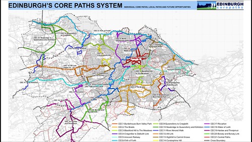
    It seems unfortunate that it hasn't built on the extensive work and public consultation of the Core Path Network process - especially the numbering system -

    In addition it doesn't mesh neatly with the aspirations of the Edinburgh Waterfront Promenade project.

    ADMIN EDIT

    What route 20 is like.

    Posted 10 years ago #
  5. wingpig
    Member

    I tried a bit of the freshly-signed #9 on Friday. Shall upload a vid eventually.
    Apropos of absolutely nothing whatsoever, how long has it taken to introduce it as far as this signed-with-signs-but-standard-issue-roads-(except-for-the-old-railway) stage?

    Posted 10 years ago #
  6. Morningsider
    Member

    wingpig - the plans for the family network were first set out in the Active Travel Action Plan, which was published in September 2010. The detail of the routes themselves were set out a bit later. So, being generous to the Council here, about three years.

    Posted 10 years ago #
  7. chdot
    Admin

    "how long has it taken to introduce it"

    At least 10 years (since that particular route was 'devised').

    connectingedinburgh.files.wordpress.com/2013/04/epark.pdf.

    Posted 10 years ago #
  8. chdot
    Admin

    Previous signing system - no 'branding' or mileage.


    'H2EP' sign

    Posted 10 years ago #
  9. chdot
    Admin

    I do sometimes wonder if there is blue sign overkill (civic litter)!

    Posted 10 years ago #
  10. wingpig
    Member

    Bagh. I thought I'd recorded the entire West End - Doocot stretch (navigating only by following the signs, where they direct you into right-turns down closed-looking streets) but only got a bit on the return leg...

    [+] Embed the video | Video DownloadGet the Video Widget

    ...when I probably only switched it on in case that black hatchback with the daft wheels tried a second close pass.

    Posted 10 years ago #
  11. Focus
    Member

    @ chdot

    "I do sometimes wonder if there is blue sign overkill"

    Ah, but they are handy for pointing out to non-cyclists that it is actually a cycle route too! (see today's bad driving thread) ;-)

    Posted 10 years ago #
  12. chdot
    Admin

    "handy for pointing out to non-cyclists that it is actually a cycle route"

    True, but having read your other post, think non-cyclists don't know what blue signs are for!

    Posted 10 years ago #
  13. chdot
    Admin

    "

    The ATAP ‘Family Network’ is now available to view on the Council’s GIS Atlas including timescales and signed routes:

    "

    http://217.174.251.127/atlas/cecatlas.html

    Posted 10 years ago #
  14. chdot
    Admin

    Don't know if 8, 9, 10, 20 have been completely signed yet(?)

    Any others started/finished?

    Posted 9 years ago #
  15. HankChief
    Member

    I think routes 8 & 9 have been fully signed now. New Cycle Route Signs Thread

    I have had colleagues say that they have used route 9 signs to navigate out to the airport.

    Posted 9 years ago #
  16. chdot
    Admin

    If you've studied the map near the top of the page you'll see there is a lot still to be done.

    So I was a bit surprised to find references on the CEC website to Highway Cycle Route 61.

    Not so much revisited as never encountered.

    "

    As part of the Council’s Family Network Cycle Route 61, The Pillars footpath is to be redetermined to cyletrack to allow both cyclists and pedestrians to use the route.

    Sections of the footways on Moredun Park Gardens and Gilmerton Road will also be redetermined to cyletrack.

    "

    http://www.edinburgh.gov.uk/download/downloads/id/4885/rso1503_statement_of_reasons.pdf

    "

    As part of the Council’s Family Network Cycle Route 61, an existing Pedestrian Crossing is to be upgraded to a Toucan Crossing at Niddrie Mains Road, Niddrie Marischal Street and Hay Drive junction. To allow both cyclists and pedestrians to access the crossing sections of the footways leading to the crossing need to be redetermined to cyletrack.

    "

    http://www.edinburgh.gov.uk/download/downloads/id/4890/rso1504_statement_of_reasons.pdf

    "

    As part of the Council’s Family Network Cycle Route 61 a shared use cycletrack is to be constructed on Lasswade Road.

    In order to construct the cycletrack sections of footway and carriageway require to be redetermined.

    "

    http://www.edinburgh.gov.uk/download/downloads/id/4881/rso1502_statement_of_reasons.pdf

    That's the COMPLETE set of references to FNCR61!

    Secret stealth network without any apparent context or consultation.

    Posted 9 years ago #
  17. chdot
    Admin

    Putting those three points into CycleStreets produces -

    http://www.cyclestreets.net/journey/43779772

    I suspect the idea is something like the Quietest route.

    Balanced includes the Burdiehouse Burn, but also the 40mph section of Lasswade Road.

    So a signed route from the Innocent to Roslin?

    I think we should be told!

    Posted 9 years ago #
  18. rbrtwtmn
    Member

    Openstreetmap based mapping is a pretty good way to keep track of what's actually built/signed. It's accurate too. There's nothing an OSM mapper likes so much as a good bit of cycle route... relatively fast to map once you know how, shows up well... so they are no sooner signed then they are mapped on OSM by someone or other.

    Good site to see this is here (which brings out the formal routes well):
    http://cycling.waymarkedtrails.org/en/?zoom=13&lat=55.94049&lon=-3.19981&hill=0

    Or the more standard 'opencyclemap' version here (shows lots of 'other' bits of cycle network too):
    http://www.openstreetmap.org/#map=13/55.9523/-3.2269&layers=C

    Posted 9 years ago #
  19. chdot
    Admin

    Is there an OSM tag for provisional/proposed?

    Might be useful...

    Posted 9 years ago #
  20. chdot
    Admin

    "Good site to see this is here (which brings out the formal routes well)"

    I'd forgotten that route 20 signing isn't complete - though it goes further than Leith Walk (mentioned on some signs).

    http://citycyclingedinburgh.info/bbpress/topic.php?id=12733

    Posted 9 years ago #
  21. rbrtwtmn
    Member

    chdot - the Openstreetmap convention has been to tag a proposed route as state=proposed (in the OSM route relation). See here:
    http://wiki.openstreetmap.org/wiki/Cycle_routes#Relations

    (Anyone who wants to know what an Openstreetmap 'relation' is ask me on a separate thread or by message)

    The well known Opencyclemap rendering of OSM (my second link above) shows these as dotted lines for the National Cycle Network. There's no guarantee that it's therefore set up to do the same for proposed local cycle network routes, but it may well be.

    Note that things can get a little complicated because if part of a route is proposed and part open then you need two route relations to account for this... which means each change resulting in the need to edit two separate relations.

    Whether any other renderings of the OSM data take account of proposed cycle routes I don't know.

    Posted 9 years ago #
  22. chdot
    Admin

    Thanks, I almost understand...

    There is a part-route (FCN 61) marked on-road from Gilmerton Dykes Street to Lasswade Road. (Doesn't seem to be marked on OSM.)

    Posted 9 years ago #
  23. kaputnik
    Moderator

    The location of this bit of "shared use path" at Parsons Green Primary must surely be some sort of safer routes to school concession. I just don't know how they expect the chiddlers to get safely up the hill to it in the first place? Oh, and it's on the side with a stepped kerb down to the road so no easy way to get on/off if pavement is blocked. Also on the opposite side from the school meaning at least one unnecessary crossing of the road for any child who wants to use it.

    I'm sure it let the council clock up a few metres of "off road family network" though for their press releases.

    Posted 9 years ago #
  24. rbrtwtmn
    Member

    chdot: if you don't know how to edit an OSM relation yourself (it's not the simplest thing to learn ... although once you know how it's a simple thing) then add a note to the openstreetmap.org map to say there's something missing/wrong. The button for this kind of note is on the right hand side of the openstreetmap.org window. A local mapper will pick it up sometime as a task to fix.

    Posted 9 years ago #
  25. drnoble
    Member

    robert, were you meaning me? :p

    I had a look today and didn't see any signs saying it was FCN61, but added the route to OSM without a reference http://www.openstreetmap.org/relation/4743249

    Posted 9 years ago #
  26. chdot
    Admin

    He probably meant me!

    There are no markings (when I said "on road" I meant painted cycle symbols) and I haven't seen a map.

    Only reverences to it are up thread.

    Posted 9 years ago #
  27. smsm1
    Member

    OpenCycleMap does show the proposed cycle routes as a dashed line, e.g. as shown here in Ipswich: http://www.openstreetmap.org/#map=18/52.04910/1.16501&layers=C

    Here is the related relation: http://www.openstreetmap.org/relation/3640484

    Posted 9 years ago #
  28. drnoble
    Member

    I spotted when out today on the NEPN that Quiet Routes 11, 13, & 14 have been signed radiating out from five ways junction.

    I've added these to OSM, so they should show up in cycle streets/the cycle layer next time they are updated. They already show up on http://cycling.waymarkedtrails.org/en/?zoom=14&lat=55.97217&lon=-3.19363&hill=0.205&base=0.7#

    Has anyone spotted any other new signs?

    Posted 8 years ago #
  29. chdot
    Admin

    Interesting map.

    Anyone know if route 61 has actually been signed (esp around Greendykes + Niddrie)?

    Posted 8 years ago #
  30. drnoble
    Member

    Chris: 61 is only signed between Gilmerton Road and the bypass. Through Niddrie there are blue cycle signs, but its not numbered.

    I think there was a sign at the Morrisons explains it wasn't signed yet, until a few bits of the route are upgraded, but I can't quite remember

    Posted 8 years ago #

RSS feed for this topic

Reply »

You must log in to post.


Video embedded using Easy Video Embed plugin